
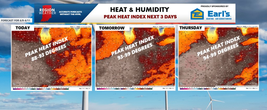
THE HEAT & HUMIDITY CONTINUES
We already know the humidity is sky high, but the heat will be with us as well through Thursday with high temps pushing well into the 80s and low 90s. The combo of the two will produce heat indices that surge well into the 90s if not close to 100. Yes, it’s almost summer, but this first wave of heat is the one your body needs some time to adjust to–so make sure you take it extra easy the next few days. You know the drill. Our hottest days will be Wednesday and Thursday.
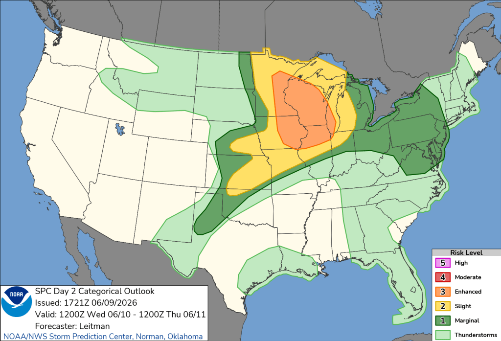
SEVERE STORMS POSSIBLE
This should be no surprise as we talked about these time windows in our Region Weather LIVE broadcast on Sunday, but this heat and humidity will also come with a severe storm risk with a few waves of storms potentially impacting the Region or areas close to it. We’ll have additional pop-up thunderstorms later today, but we’re not expecting any widespread severe weather with any of these. The timeframes we are watching are for a potential wave of storms later Wednesday and another one later Thursday. Both of these will have some movement to them as the jet and upper air dynamics will begin to come into play. We have higher confidence in the severe potential for later Thursday, but we’ll need to keep a close eye on both days.
Wednesday Severe Zones
Thursday Severe Zones
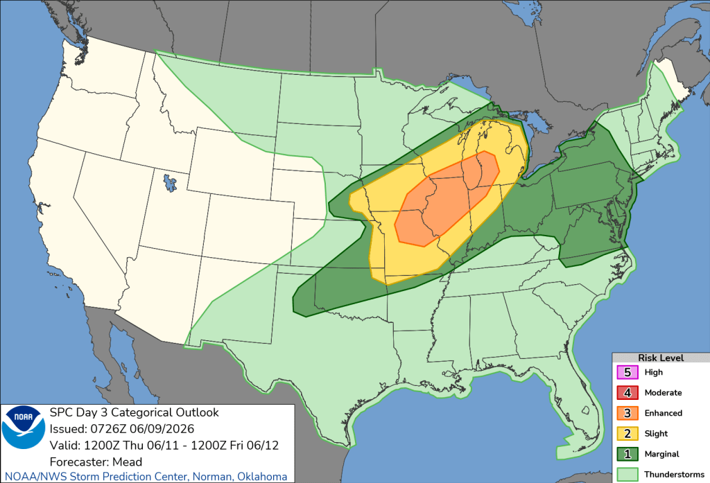
In full transparency–model guidance tries to determine when these storms fire and where they go–but they’ll change 100 times between now and then simply because this is one of those complex setups that relies on exactly where and when storms develop the hours prior–and much like a chain reaction–if the storms fire this afternoon a few miles off from where model guidance thinks they will–the forecast gets thrown off exponentially the longer we go out into forecast time. So in summary, we’ll be watching for a potential complex of storms at some point Wednesday and another on Thursday with the front. Both would favor a PM timeframe vs overnight or morning. Stay tuned!

Yikes and it is not Summer yetâ¦.lol
Thanks Matt!
LikeLike