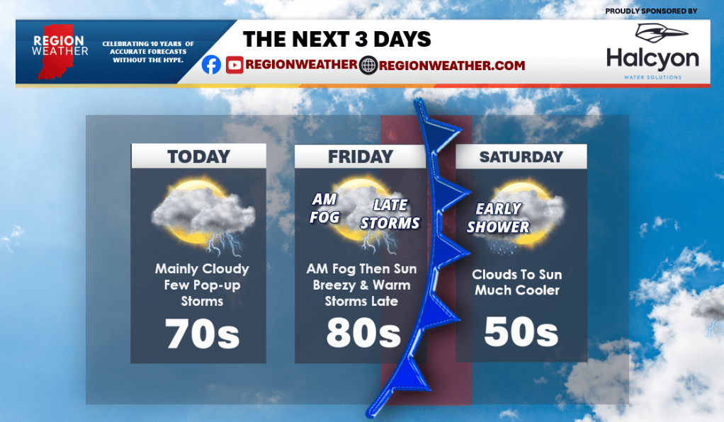
We have a powerful cold front in the western US that will quickly head our way over the next 48 hours bringing a chilly end to the weekend to the Region. Between now and then, we have a few leftover pop-up showers and storms today as the initial low pressure we’ve had the last few days pushes out. Cooler with fog tonight. Then tomorrow that stronger front will approach with sunshine and windy conditions. Temps will surge into the 80s and much of the afternoon and evening will be dry. We’ll then watch a line of strong storms to our west work in late tomorrow evening. Some of the storms could be severe when they move in. Much cooler air moves in Saturday and Sunday.