
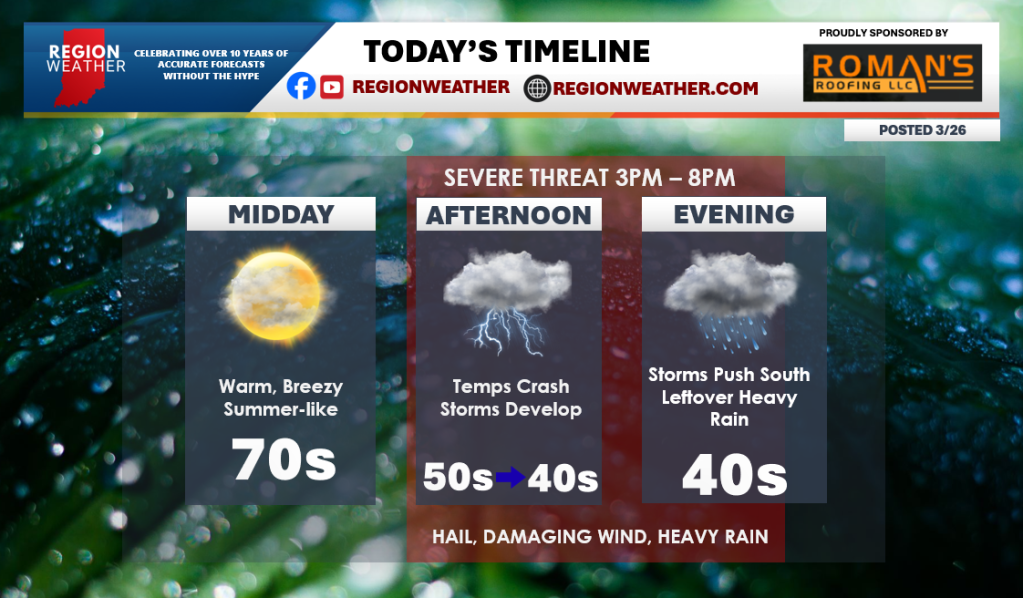
Good Thursday morning everyone–we have a weather day that you’ll need to pay attention to as strong to severe storms are likely this afternoon. (see our broadcast last night for more details). Let’s talk timing today. Temps will rise to summer-like levels through the midday hours before a front settles south off the lake. This front will cause our temps to plummet with 40/50 degree air heading south through the Region this afternoon. At the same time, storms will rapidly develop and move through bringing a large hail threat in addition to heavy rain and damaging wind. There still is a tornado threat, but our biggest threat will be the hail. Everything turns to heavy rain before ending late this evening into the overnight. We’ll have LIVE coverage on our Facebook and YouTube page with any warnings that pop in the Region this afternoon and evening–make sure you’re connected with us.

Thank you Matt
LikeLike