
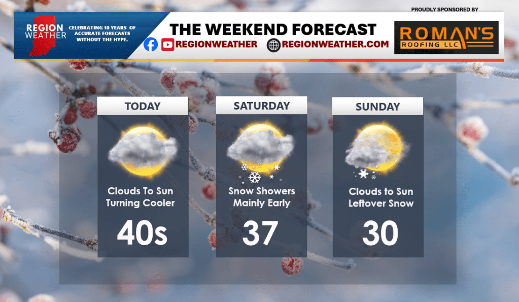
Happy Friday! A cold front is now through the Region as of this Friday morning and we’ll be noticing the falling temps through the rest of the day. We’ll fall through the 40s into the 30s later today with our gusty wind easing back pretty quickly. Expect a round of snow showers to greet us Saturday morning before backing off by afternoon with just scattered snow showers expected the rest of the weekend. We’ll turn colder Saturday and Sunday with highs falling back below average for a brief period before milder air moves back in to start next week!

Thank you Matt!
Happy weekend.
LikeLike