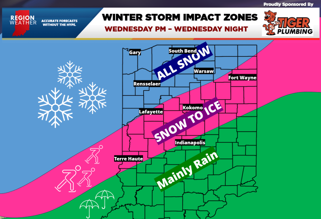
We’re getting a better idea of how this winter storm will evolve regarding the track and intensity of the low–so it’s not too early to look at impact zones regarding precip type. Remember in terms of timing–we’re expecting this system to move in during the day Wednesday with Wednesday afternoon, evening, and Wednesday night before the MOST impacted by the snow. Still too early to talk totals but over a half foot for many of our blue shaded areas is possible. A slight change in the track over the next few model runs could certainly shift these zones, but as of this post (Monday morning) we’re looking at all snow here in the Region. Snow will quickly changeover to a wintry mix with icy conditions expected to develop from Lafayette to Kokomo to Fort Wayne. Indianapolis will likely get some ice before changing over to plain old cold rain. All of these locations should change back over to some brief snow before the system departs early Thursday. Hopefully this helps for all those with travel plans Wednesday into Thursday!