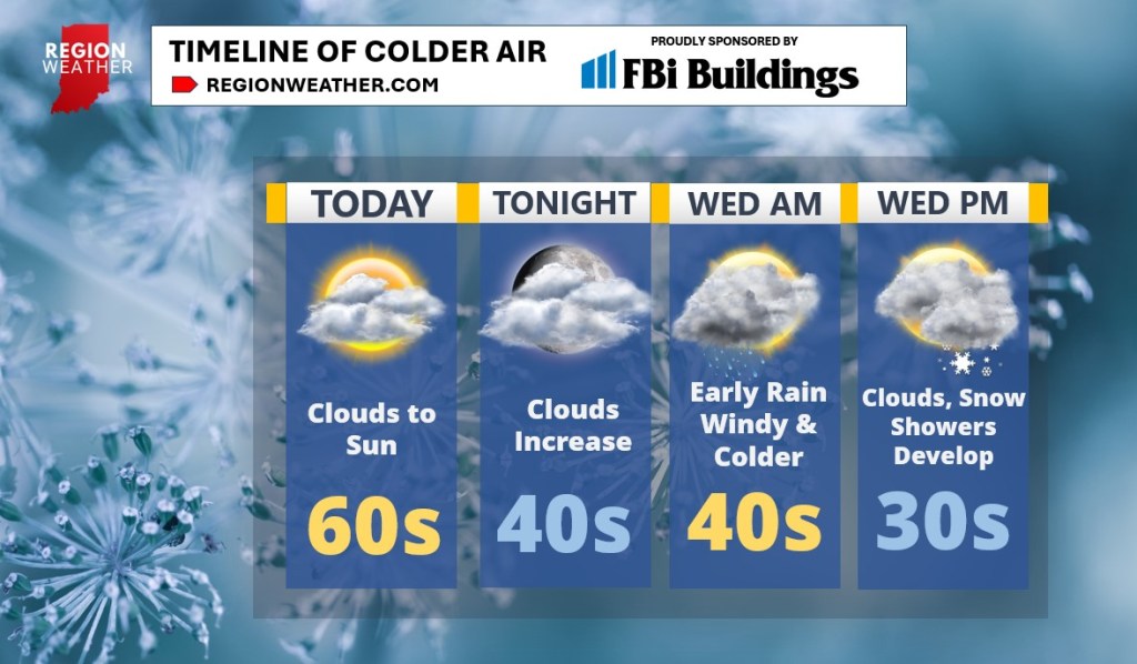
Good Tuesday morning everyone! Clouds will give way to some sunshine today with another mild day as highs push into the 60s before scaling back into the 50s later today. Clouds will increase tonight with lows in the 40s.
The temperature drop arrives Wednesday as a large pool of much colder air plows into the Region. Gusty winds and morning rain will accompany this colder air with 40s to start and 30s to finish the day out tomorrow. We likely won’t have much precip during the day before clouds and snow showers look to return later Wednesday into Wednesday night.
We’re still watching the potential for snow to drop south off the lake Thursday–this would be our slushy accumulation of snow if it verifies…I want to see the afternoon run of model guidance before honing in on Thursday’s details. Either way, snowflakes will be flying with much colder air locked in Thursday through the upcoming weekend!