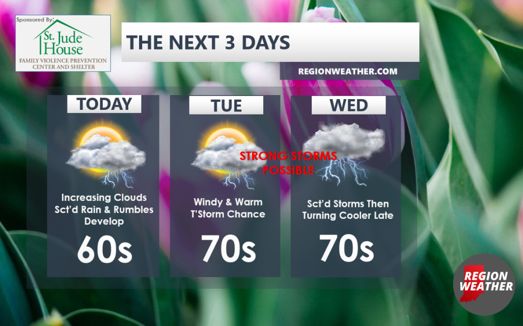
Good Monday morning everyone! We have a very spring-like start to the week, but along with that will come several chances for showers and storms. Let’s start with today–clouds will increase with scattered showers and storms popping along a warm front later today into tonight. Scattered showers and storms will stick with us through early Tuesday until that warm front advances north. Once it does, gusty winds will help our temps surge into the upper 60s to mid 70s from north to south Tuesday! There’s a chance that additional storms rapidly develop Tuesday afternoon and evening, but that threat looks to remain west of us as of now. We’ll stay incredibly warm Tuesday night with temps staying in the upper 60s to near 70 all night! We’ll start warm Wednesday before showers and storms (some strong) move through with the cold front and temps scale back late day into Wednesday night. Phew! As always, we’ll update you as needed with these storms the next few days.