Happy Thursday everyone! Just a heads up, we’ll be doing a special update tonight via a Region Weather LIVE over on our Facebook page to discuss what we know, what we don’t know, and what to expect with this storm system. Until then, we wanted to do a quick post showing the raw data as of Thursday afternoon in regards to how much snow the models are putting out. We’re still lacking consensus in the models all due to the process of evaporational cooling and how and exactly when that takes place (it’s a very complex process!),
That being said, we’ll chat tonight. Until then, here are the latest model outputs as of Thursday afternoon. Again, none of them are truth, but we have to consider the trends, amounts, and track of these!
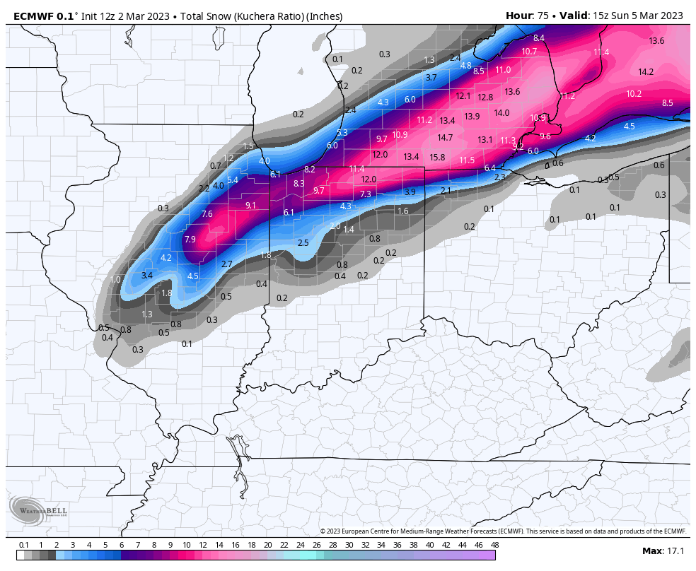
EURO
GFS

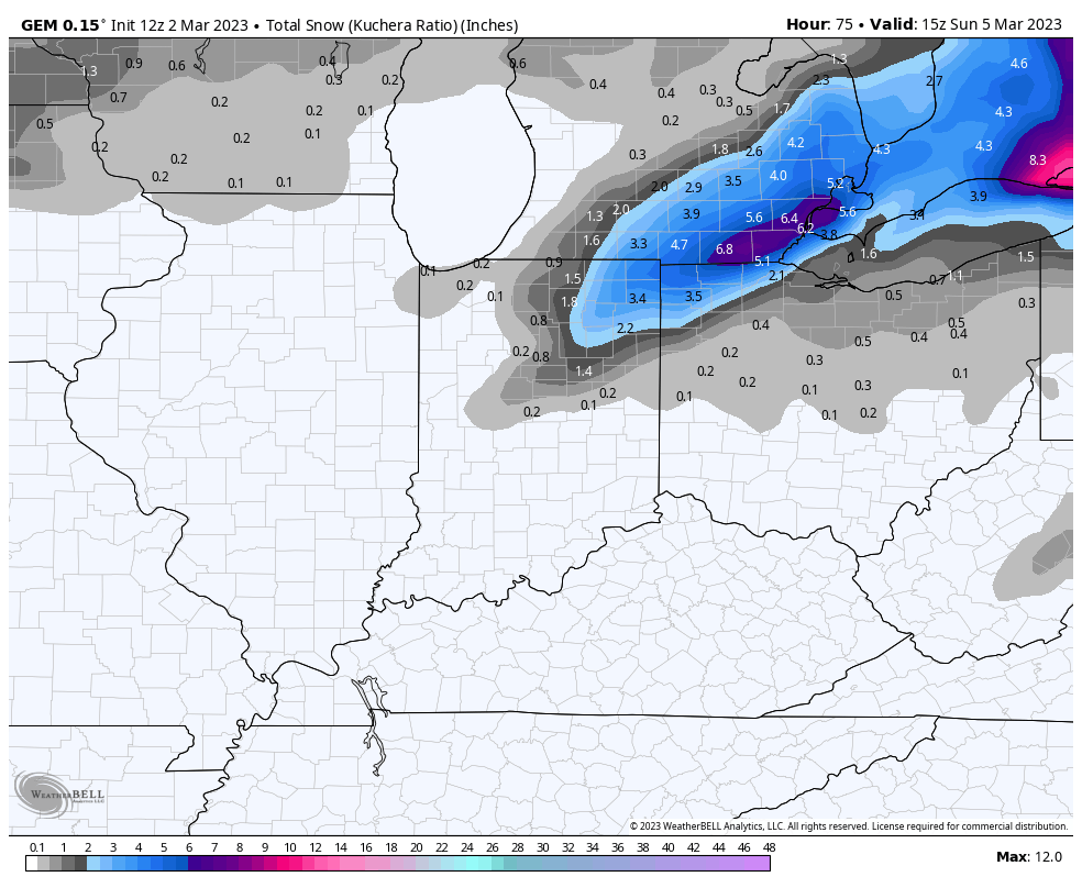
GEM (Canadian)
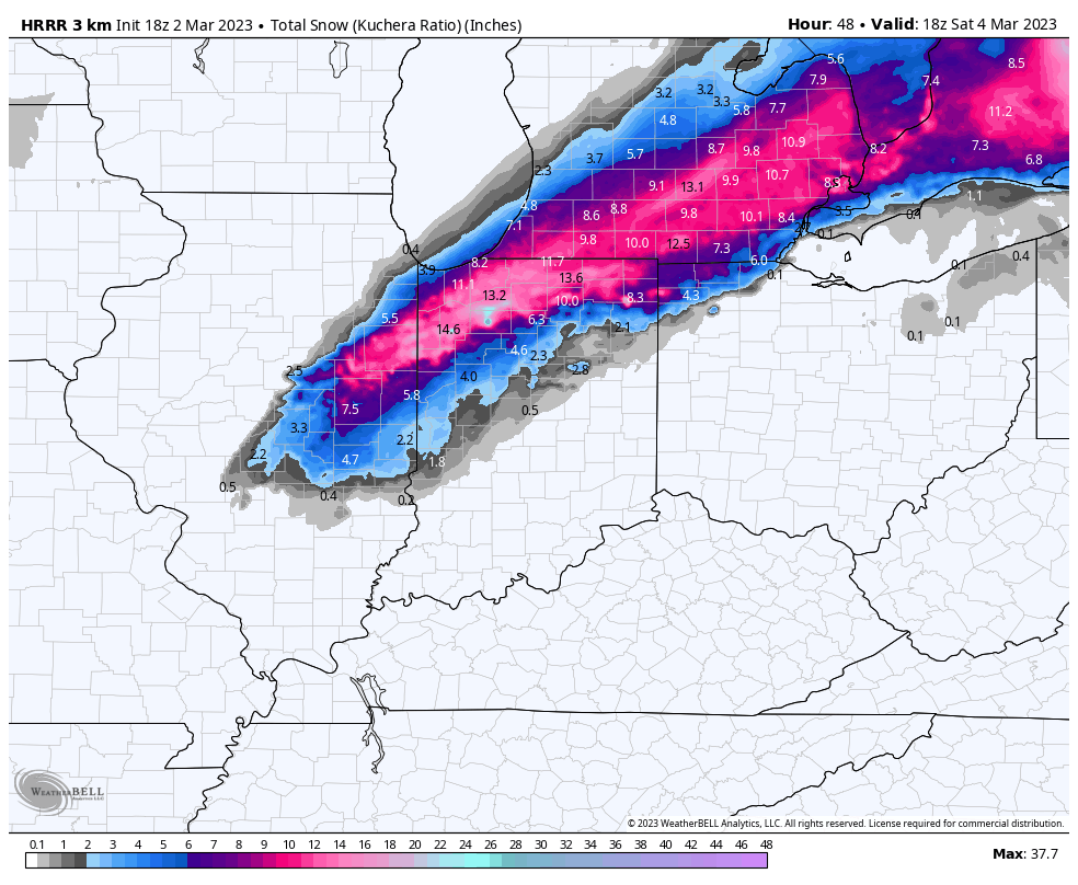
HI RES MODELS
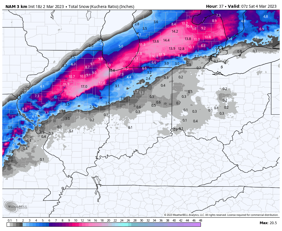
NAM
HRRR