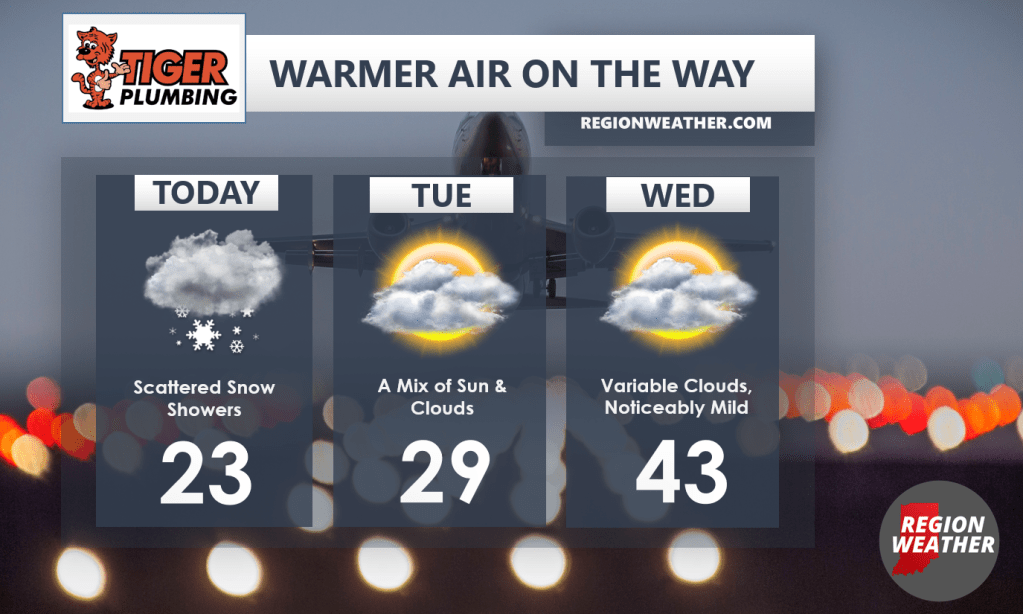
Good Monday morning to you everyone! Scattered snow showers will continue as a clipper system zips southeast through the Region–we’re not expected much in terms of accumulation from this one, just a system that will help keep the cold air in here for another 2 days. Beyond this, a huge trough develops out west bringing them more rain and heavy mountain snow (continued great news for them). Meanwhile out east, we’ll see a large ridge develop–quite the opposite pattern from last week. The result will be rising temps by Tuesday night/Wednesday with 50s likely Thursday out ahead of our next front!