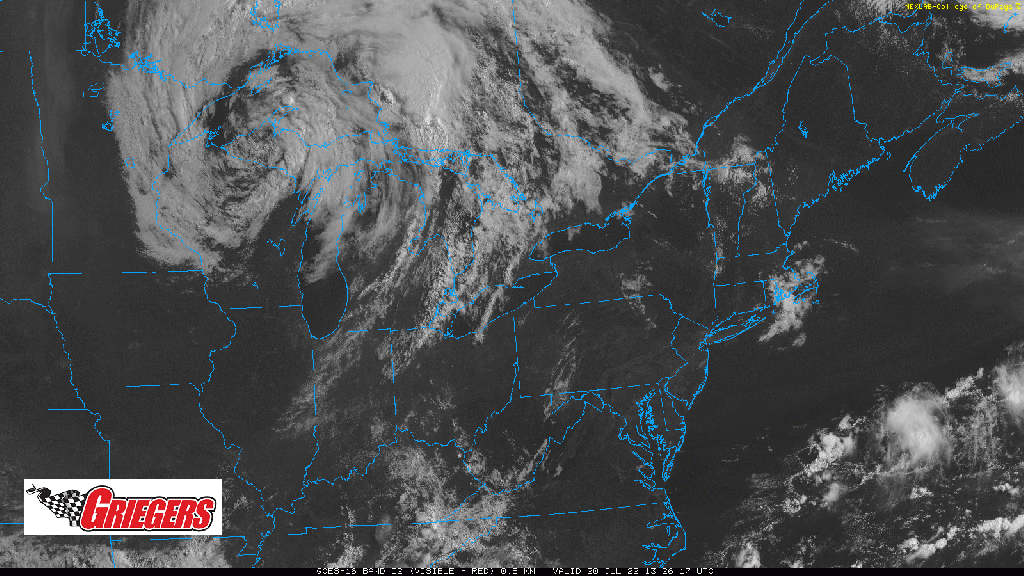
This potent area of low pressure we mentioned the last few days is now swirling its way through the Upper Peninsula of Michigan and will eventually make its way into Ontario. Trailing this low is a frontal boundary as evident with the line of cumulus clouds through southern Michigan into eastern Indiana. Storms are expected to explode this afternoon along this frontal boundary, but will be well east of us. We’ll enjoy a breezy, hot, and continued humid day with highs in and around 90. Stay hydrated folks!