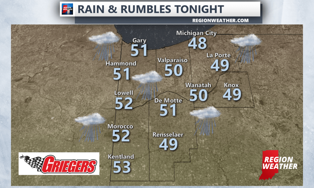
A warm front will make slow progression northward overnight with a few additional waves of showers and a few t’storms possible through daybreak. It will remain breezy and chilly before temps surge well into the 60s Saturday once that warm front clears. We’re still looking at a strong to severe storm chance later in the day Saturday. Check our morning update (as not much has changed) for more information on that! We’ll have updates throughout the day tomorrow as always.