
A large storm system continues to spin its way northeast into Minnesota while a secondary low develops to the south near Arkansas. This low is responsible for an on-going squall line of strong to severe storms that will race east through the Deep South and Tennessee Valley today producing damaging winds and tornadoes.

For us locally, we’ll reside on the very northern tip of this line. We’ll likely receive a good dose of rain on the northern end and the bulk of the severe weather will be south of us where the better ingredients are located atmospherically. However, there is a powerhouse jetstream up above us that could easily get tapped into with even a line of weak storms–so damaging winds would be our primary threat as we discussed in our Sunday Night Region Weather LIVE broadcast.
Notice how the highest threat for severe weather is south of the Region:

Waves of rainfall will be possible today into tonight with heavy rain at times. Again, we could see a few thunderstorms roll through–best timing for those would be late this afternoon into the evening. This would be the time period to watch for any damaging winds.

The potential is there for a brief period of intense wind with the actual frontal boundary passage late this evening. Look at the wind gust potential as this line moves through:
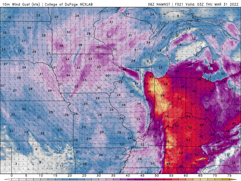
50-60 mph winds would do some minor damage–so we’ll be watching this closely.
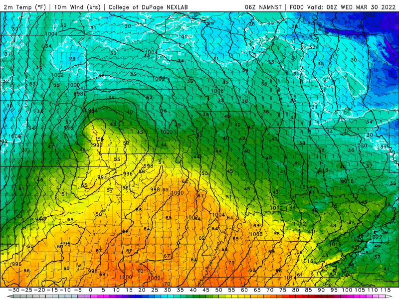
The positive side of this system is the bump in temps. Warm, humid air will rapidly arrive from the Gulf of Mexico and our temps will surge well into the 60s. We turn much colder behind the front tomorrow.
And yes, we still think we’ll be seeing snowflakes flying:
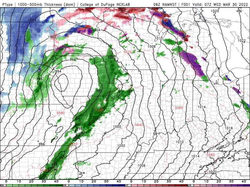
Accumulations still look minor, but a slushy coating to some light accumulations on grassy and elevated surfaces looks likely:

