The western US has been getting hammered with heavy rain and 8-10 FEET of mountain snow. While it’s a lot at once, this is good news for the low water tables due to the on-going drought. Take a look at the forecasted snow over the next few days–this is on top of the high snowfall amounts that have already fallen:

This system will quickly move east and develop a strong area of low pressure on the eastern side of the Rockies. This low will bring heavy snows to Colorado and the northern Plains, severe weather into the upper Midwest, and powerful winds to a large geographical area due to the strength of the low. Look at the extend of high wind watches, warnings, and advisories in advance of this system:

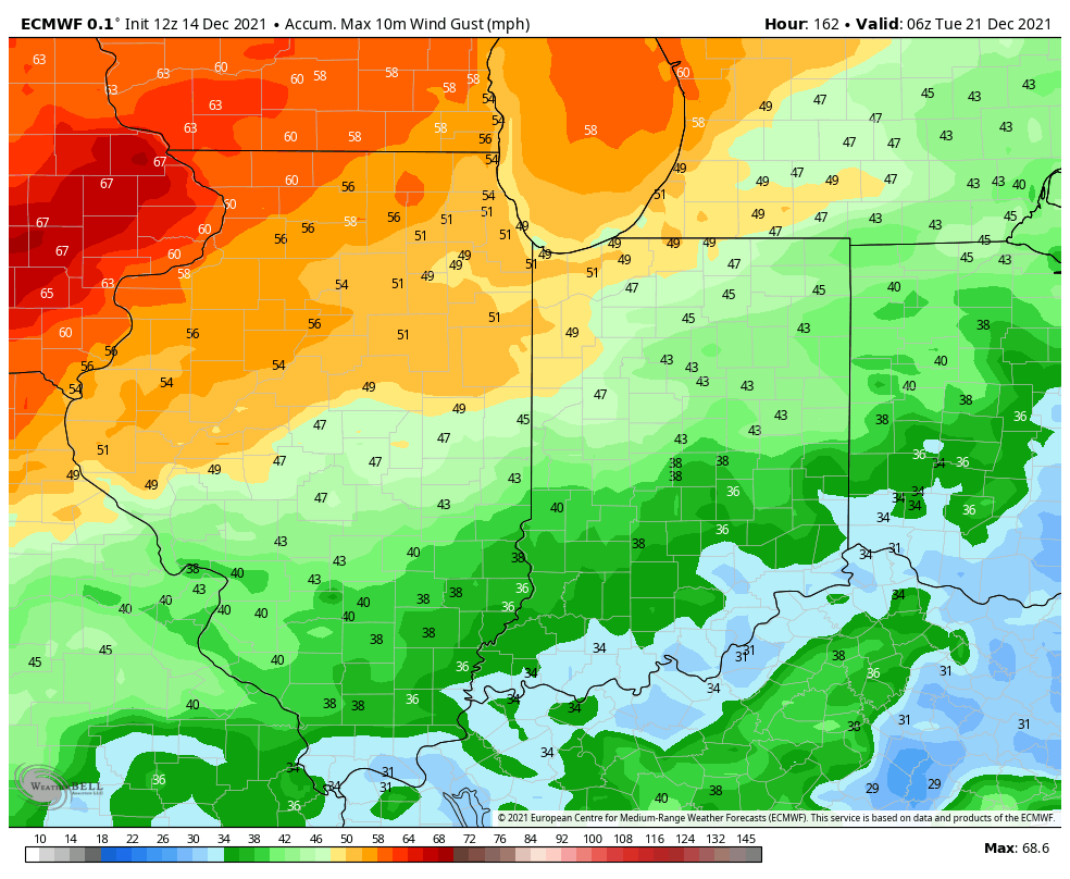
Take a look at the evolution of the strong winds as the low develops:

The strongest gusts will be in and around the actual low pressure which will pass to our west. Gusts could surpass 70 mph at times from Kansas to Iowa to western Illinois. Here are some of the top gusts forecasted from model guidance:

Our strongest winds locally will occur Wednesday afternoon, Wednesday night, and Thursday morning. The strongest gusts with this system will be to our west, but we could still see winds over 50 mph at times–a testament to the strength of the low which will be well to our west!