
It’s that time of year when we refer to low pressure systems from the northwest based on the province in Canada in which they originated! An Alberta clipper will zip out of the northern Plains this afternoon and will bring wind, rain, snow, and some lake effect before it quickly exits to the east. Let’s take a look at what we can expect here in northwest Indiana:

THE SETUP
The area of low pressure will pass just to our north. An area of snow will likely blossom on radar late Saturday into Saturday night before the bulk of the activity resides to our north. On the back side of the system Sunday morning, we’ll see a mix of snow and some rain fill in across the Region before lake effect snow takes over in the snowbelt for the remainder of the day Sunday into early Monday.
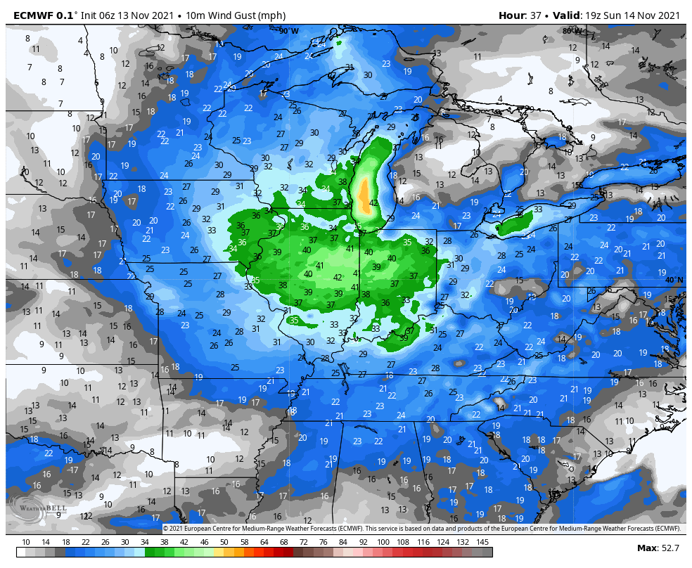
GUSTY WINDS
Wind will be quite gusty with this low as it moves through later today through Sunday. Take a look at some of the stronger wind gusts expected Sunday afternoon:
SNOWFALL
In terms of snowfall, this will NOT be a big deal for us locally. Most of us will see a coating at best, but areas of Porter and La Porte County could see a few inches of lake effect Sunday into Monday once the system departs and colder air fills in aloft. Here’s what model guidance is showing:
The Euro:

The GFS:

The GEM:

The NAM (we like best this time):

QUICK RETURN TO WARMTH
Winds will quickly turn around out of the southwest on Tuesday helping to pump warm air back into the Region by mid-week! This is out ahead of another shot of cold air–typical for this time of year as that classic battle of the warm vs cold continues until you know what wins out!

