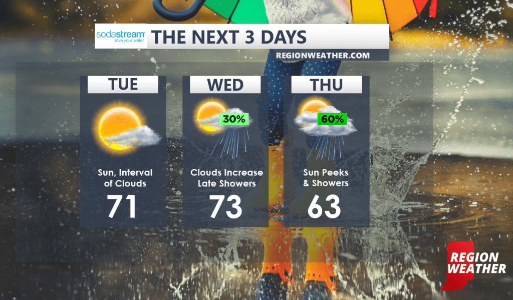
We’ll continue under the influence of high pressure today with a warm breeze helping to propel temps into the low 70s. We’ll see a passing interval of clouds, otherwise sun-filled skies will be the rule.
Sunshine will continue on our Wednesday but clouds will become more common as our next system approaches from the west. Highs will once again be on the mild side as they reach the low to mid 70s.
By late Wednesday we’ll run the risk of passing showers and showers will become likely Wednesday night as a cold front moves through the Region. It doesn’t look like we’ll see a lot of rain from this system, mainly just some showery weather. Leftover showers mixed with sun peeks on Thursday will accompany cooler temps and a gusty breeze. Highs Thursday behind the front will only reach into the low 60s. Even cooler air settles in from the north for the weekend with highs in the 50s at this point.