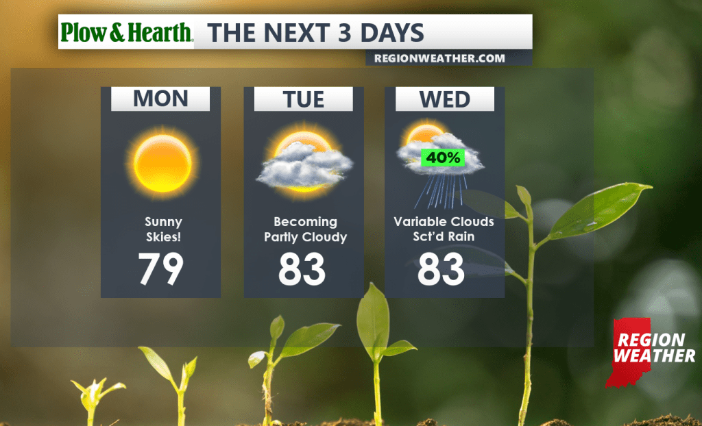
You wouldn’t know it, but tropical moisture and thick clouds are just off to our east, but high pressure will remain in control for one more day bringing us a sun-filled start to the week! Clouds will begin to increase Tuesday into Wednesday as the remnants from Fred head up the spine of the Appalachian Mountains. While we won’t see a direct impact here in the Region, a frontal boundary will move closer by mid-week putting us on the western periphery of pop-up shower and storm chances beginning Wednesday.