
We’re still expecting a frontal boundary to move in and stall this weekend into next week bringing rounds of storms to the Great Lakes. Most guidance focuses the heaviest rain right through the Region as several waves of energy will likely trigger large areas of heavy rain and storms–all depends on where they decide to go.
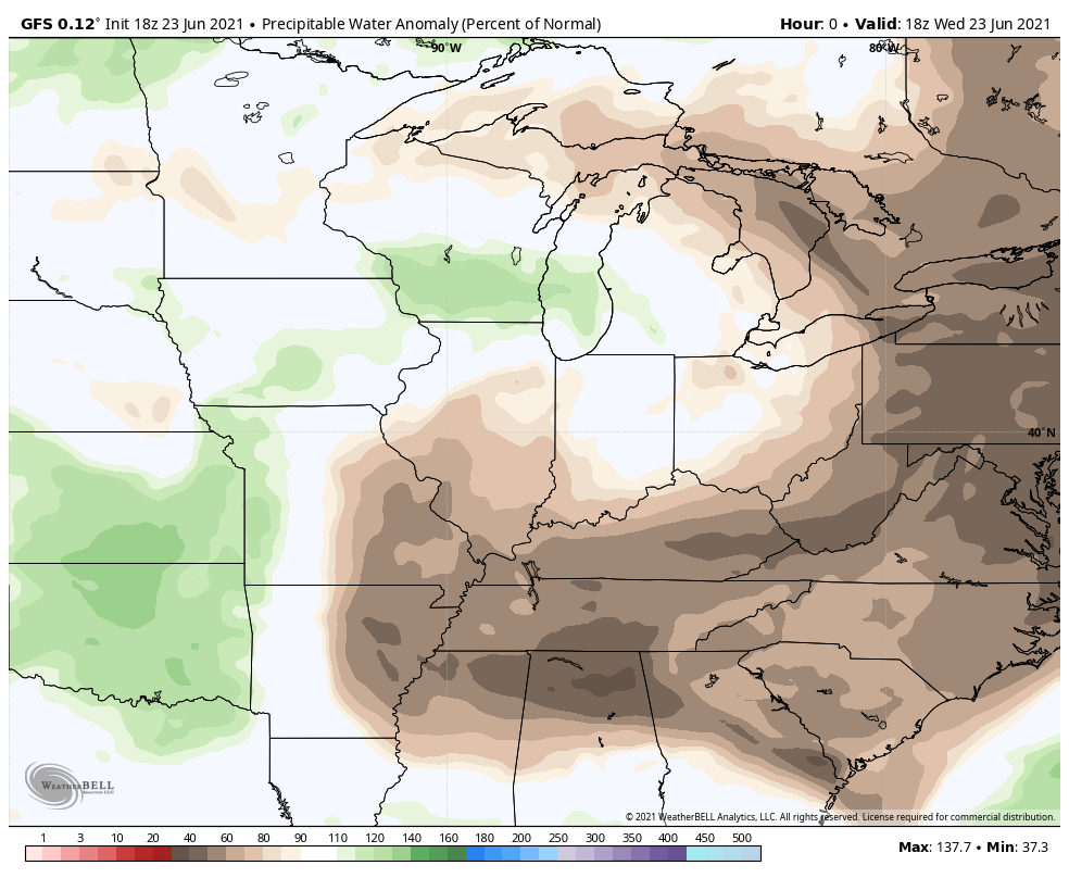
Below you’ll see the increase (and staying power) of the atmospheric moisture which goes from 40% of normal to over 200% of normal at times. As a result any storms will be capable of producing some very heavy rain and that threat will continue through at least early next week.
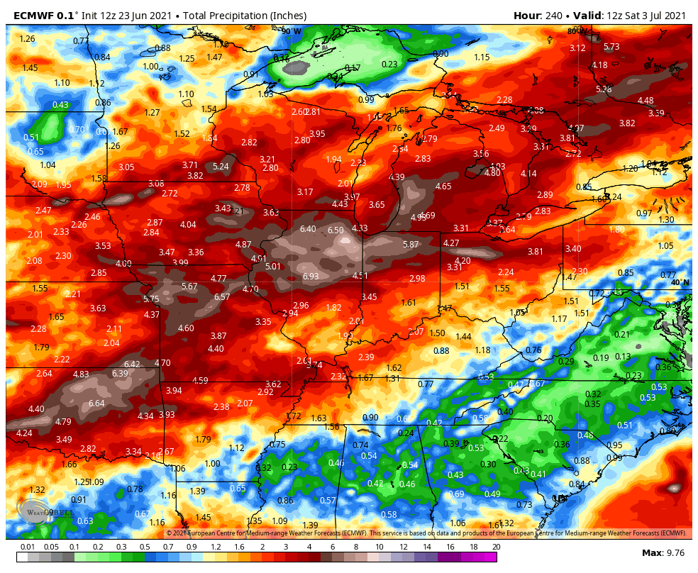
As a result, here are some of the rainfall amounts guidance is coming up with over the next 7-10 days–keep in mind rainfall from thunderstorms does not fall evenly. We also look at this for trends rather than exact amounts in exact locations:
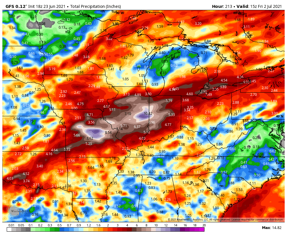
The GFS is particularly bullish:
We’ll keep you updated!
