Happy weekend everyone! If you have things to do, this morning and midday is the time to do it. Conditions will go downhill quickly later this afternoon, evening, and into tonight. Here’s a look at our system this morning as thunderstorms and heavy rain developed overnight with that surge of moisture heading our way:

And a look at how it’ll come together today:

If you’ve been joining us on our Region Weather LIVE broadcasts, not much has changed since our Friday evening broadcast although the onset or beginning of the event may briefly start as some rain or freezing rain in Newton and Jasper counties before changing over to snow. Here’s a recap of what to expect today:
SATURDAY AFTERNOON
Snow develops and may initially start out at rain or freezing rain in Newton and Jasper counties before changing to snow. The snow will then become heavy at times. Snowfall rates of 1-2 inches per hour possible at times. We’re still expecting the potential for isolated thundersnow. This snow will be very dense and wet–difficult to shovel and plow. Travel conditions will deteriorate rapidly.
SATURDAY EVENING
Widespread snow and heavy snow continues. Roads will likely be a mess and travel will be difficult. Winds will be gusty out of the east-southeast at 25-35 mph. With a wet snow, there won’t be a lot of blowing snow, but the weight of the snow on trees and powerlines could lead to power outages. The potential for thundersnow is possible in some of the heaviest snow.
SATURDAY NIGHT
Snow will taper off to light snow and become more on & off overnight. Winds will continue to gust over 35 mph at times and road conditions are likely to still be difficult.
SUNDAY
Periodic snow showers will continue and may mix with some rain and drizzle to the south. We’re not expecting anything impactful Sunday, but the residual effects from the Saturday snow will likely still be felt, especially on side roads etc.
TIMING OF THE HEAVIEST SNOW
From the NWS:

HOW MUCH?
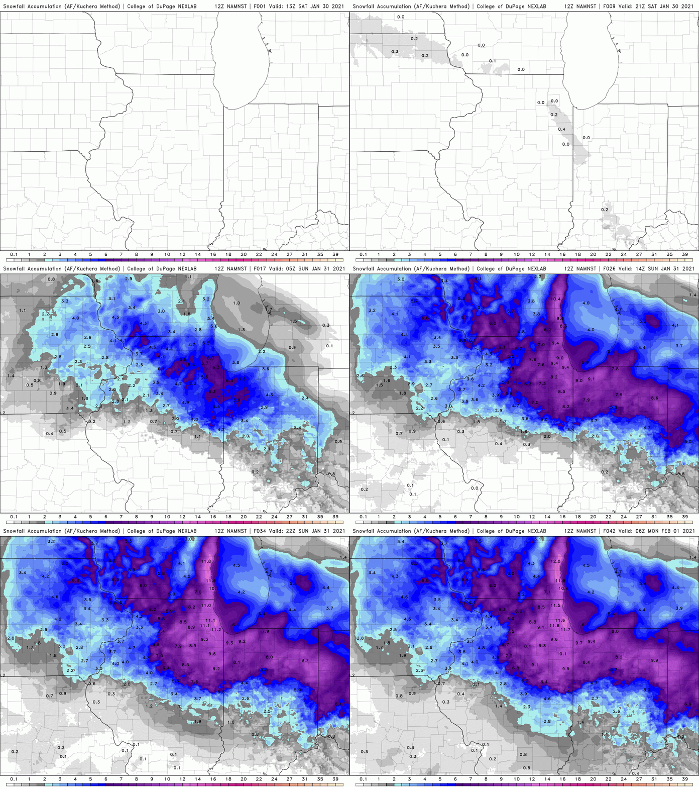
We’re expecting a widespread 4-9 inches with isolated higher amounts for ALL of NW Indiana through late Sunday. The bulk of this will fall quickly this afternoon into early tonight with lighter additional amounts expected on Sunday:

FOCUS ON IMPACTS
Regardless of the exact amount of snow you get, focus on how it will impact your plans, etc. This afternoon, evening, and overnight will see the highest impacts from this event before conditions slowly improve Sunday.
We’ll have updates for you throughout the event on our Facebook Page as always!
