
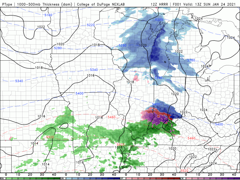
The winter storm set to impact a large portion of the Midwest into Ohio Valley is now onshore producing heavy rain, wind, and incredible mountain snow to areas of southern California. The storm will move through the southwestern US today and will eject out into the southern Plains tonight eventually making it’s way towards the Region Monday. This storm will bring a wintry mix of snow, sleet, and some freezing rain to our southern counties (Newton, Jasper, Starke) and accumulating snow with some wintry mix to our northern tier of counties (Lake, Porter, LaPorte).
Our forecast hasn’t changed much since Saturday with this one, but we can really begin to hone in on the details. As always, we like to start big picture. Let’s start with a simple timeline.
TIMELINE
Monday Midday-storm moves IN
Tuesday Afternoon-storm moves OUT
Now let’s get into the details on what we expect to happen in between those two timeframes. Keep in mind, this is our forecast, or attempt at predicting the future, it’s not set in stone but our confidence is fairly high with this one 🙂
MONDAY MORNING
Cloudy with a few lake effect snow showers with our northeast wind off the lake
MONDAY MIDDAY
Big wet snowflakes moving in from the south into Newton and Jasper counties
MONDAY AFTERNOON
Big wet snowflakes move north into Lake, Porter, LaPorte counties while a mix of snow, sleet, and some freezing rain takes over in our southern zones. Forecast note: we are likely to see some breaks in the precip during this time with some drier air getting into the system–it happens frequently in bigger storms. Wind will begin to ramp up as well into the 15-25mph range with a few higher gusts in the 30s. Not a huge wind event as we could see with some winter storms, but still formidable.

MONDAY EVENING
Snow continues to fall and could be heavy at times in our northern counties, especially Lake County with a few periods of wintry mix possible in Porter and LaPorte counties within the snow. Meanwhile a mix of snow, sleet, and freezing rain continues across our southern counties with some icing issues.
MONDAY NIGHT
Most locations turn over to mainly snow showers with some breaks in the snow possible. We’ll have to watch areas close to the lake as lake enhanced snow is possible as the winds begin to turn off the lake (basically higher snowfall rates).
TUESDAY
Snow showers continue with some lake enhanced snow likely in and around the lake, especially from Lake County into Chicago with a northeast wind. That lake enhanced snow will likely move into Lake, Porter, and LaPorte counties later in the day Tuesday as winds continue to shift to the north and northwest. Elsewhere snow showers with breaks.
IMPACTS
Conditions will begin to go downhill Monday afternoon with Monday evening turning messy. Tuesday we’ll deal with issues from the snow, especially near the lake (best chance Lake County into Chicago) where accumulating snow and potentially heavier snowfall rates will make travel tough. Conditions should begin to improve Tuesday night.
Ice will be an issue in Newton, Jasper, and Starke counties with slick surfaces and a wintry look to the landscape. Power outages should be kept in check as icing doesn’t look to be major, but it’ll likely be problematic, especially for travel.
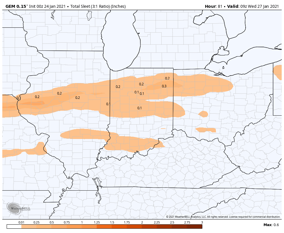
SLEET ACCUMULATION
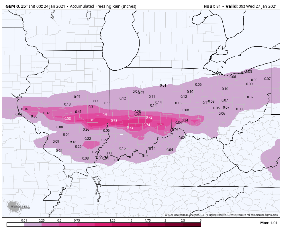
FREEZING RAIN ACCUMULATION
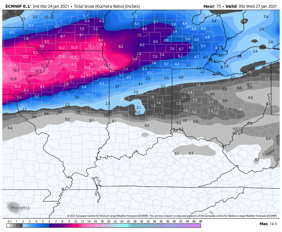
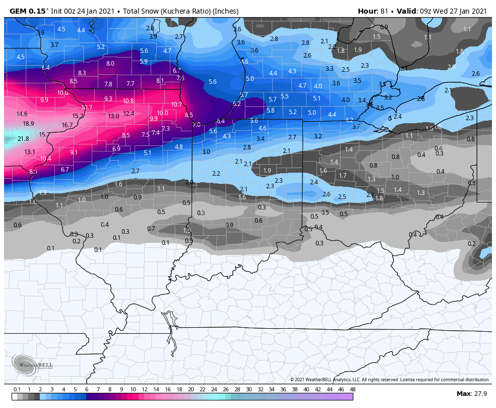
In terms of snowfall, I think Tuesday will be the main day for snow as we combine system snow with lake enhanced snow. The storm itself will produce some periods of heavy wet snow, but I have a feeling Tuesday is the day that it consistently adds up, especially in Lake County as we bring the lake into play. Here’s the Sunday morning suite of models:
EURO
GFS

GEM
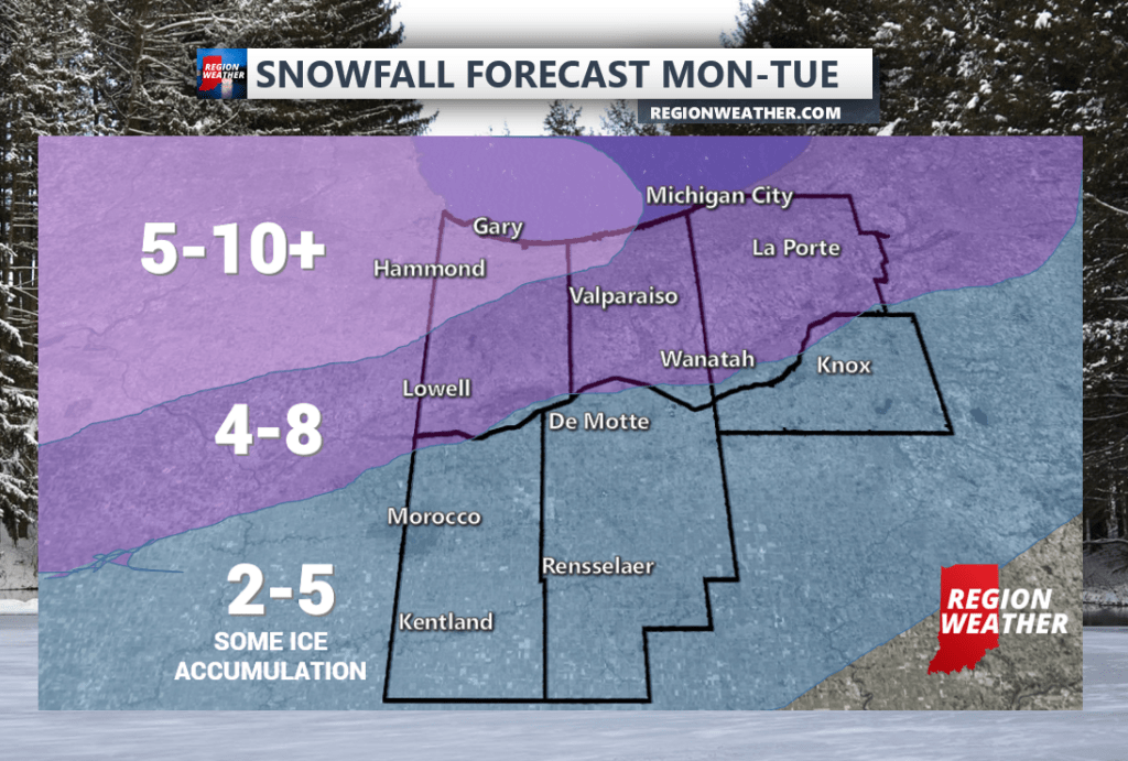
Here’s our official snowfall forecast as of Sunday morning:
We’ll continue to pass along the latest and will have another Region Weather LIVE broadcast on our Facebook Page Sunday evening. Feel free to stop by and join us to discuss the latest.
