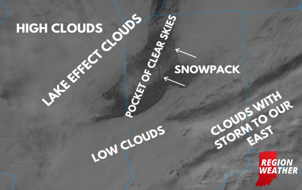
Although our weather pattern remains rather “stuck”, there is a lot going on via the satellite picture today!
High clouds are floating in from the west, lake effect clouds and flurries stretch from Lake County back into Chicago due to a northeast wind from the winter storm to our south.
Meanwhile a pocket of clear skies continues to spread southwest through the Region revealing a view of the snow on the ground from space.
South of that they’re socked into those low clouds once again downstate.
Phew! Take a look: