
Winter Storm Warnings are in place today in the western US. Those same locations will see highs in the 90s to near 100 today. Incredible!
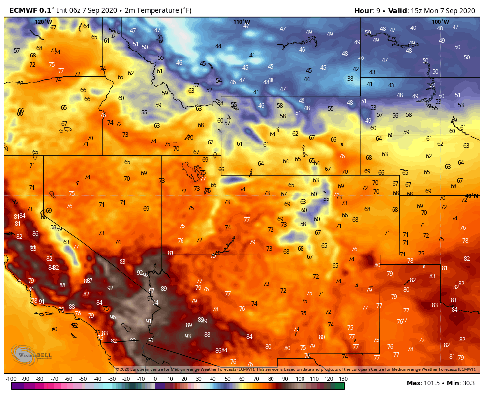
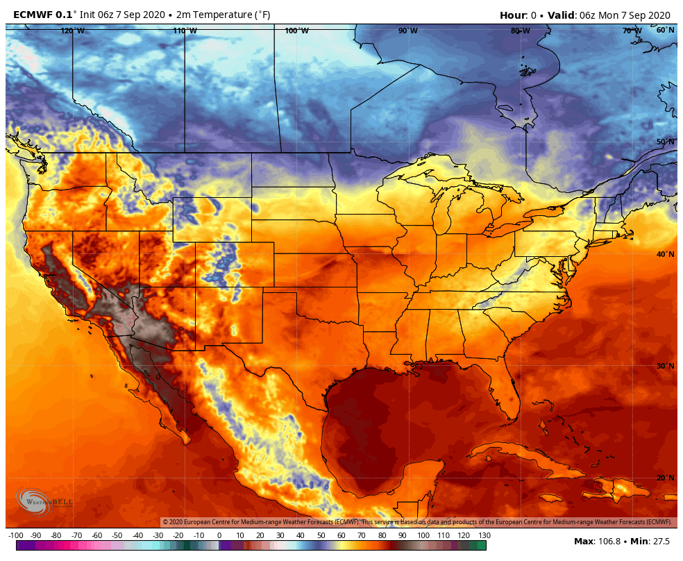
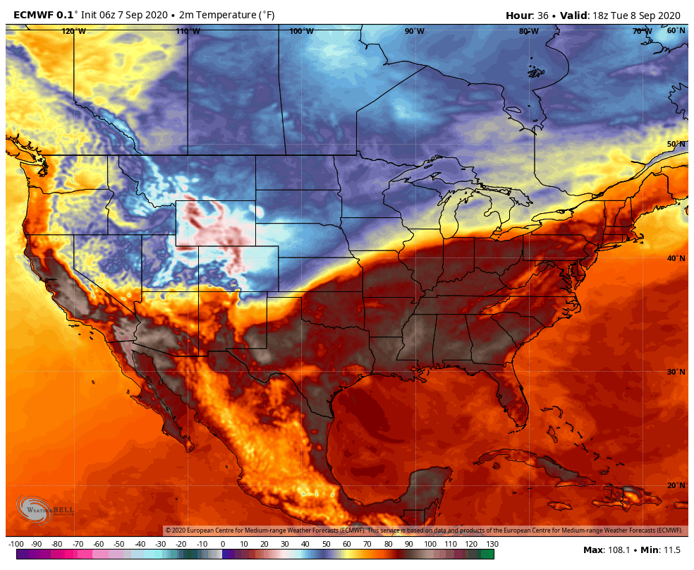
A strong, late summer storm system is descending on the inter-mountain West from Canada and will bring some wild weather changes in the next 24 hours. Denver, for example, has been in the upper 90s to near 100 the last two days. They’ll likely hit the upper 90s again today before temps crash. In 12 hours, the temps will drop all the way into the 30s and snow will begin to fly. And then accumulate! Look at the unseasonably cold air moving south into the western US:
The rain will quickly change to snow where over a foot is possible in the mountains!

Here are some of the projected snow totals:

Keep in mind what we say often: what goes down must come up (and vice versa). The big dip in the temps (and flow of weather) to the west, like a teeter-totter, will spring heat and humidity northward in the eastern US:
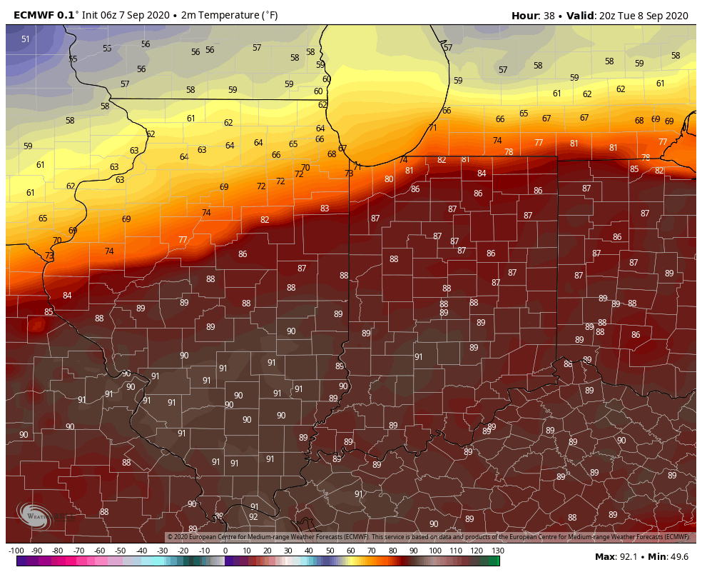
This will set up quite the temp contrast over our area Tuesday and Wednesday. We’ll be divided by a front and on the northern side, temps will hold in the 60s. (with 40s for highs in Wisconsin!). South of the front, temps will reach well into the 80s with humidity:
A closer look at how the highs might shape up Tuesday. Expect a similar look on Wednesday:
In terms of rain and storm chances, we’ll see showers and storms return tonight into Tuesday before everything lifts north for a bit going into Wednesday. Rain will then ramp up again late Wednesday into Thursday as the cooler air really works into the Region and moves east.
