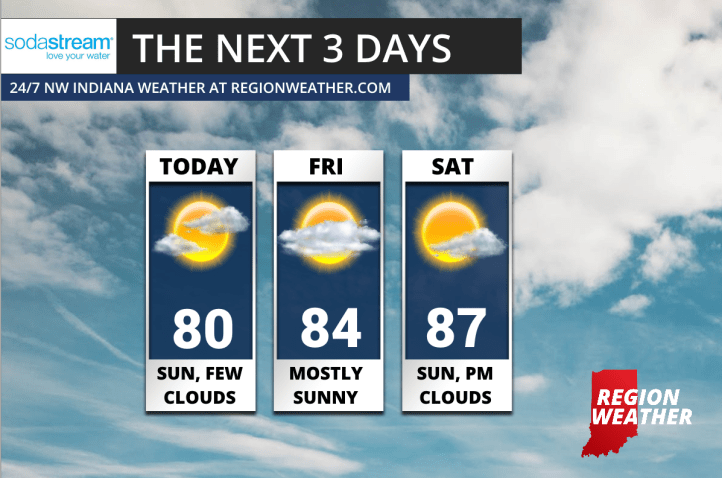
What a pleasant stretch of weather that’s unfolding for the Region. The slow-moving frontal boundary that brought periodic showers and rumbles the last few days has now pushed east and high pressure is taking control of our near-term forecast.
Expect sun with passing clouds over the next 3 days with heat building back into the Region. We’ll have a nice breeze out of the north (off the lake) through Friday night before the wind switches around and brings heat and humidity back in here for the weekend. Highs will likely reach the upper 80s Saturday and into the 90s Sunday with storm chances returning later in the weekend and to start next week!