
SEVERE THREAT LATE TONIGHT INTO TONIGHT:
As always, when the Storm Prediction Center puts out any threat for severe weather in the Region, we like to take a closer look and share the details with you so you know what to expect. Here’s the severe weather forecast from the SPC for today (Wednesday):

You can see that the bulk of the severe weather is expected across Illinois and Missouri. I have to be honest, I think the severe weather threat is low later today and tonight for us here in the Region and the main cluster of strong storms and greatest instability should pass just to our south.
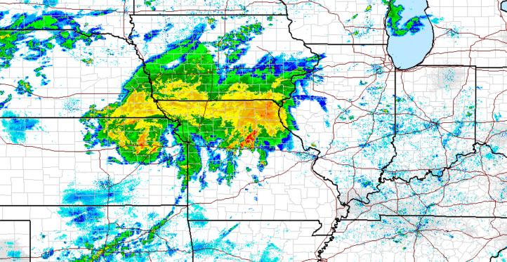
BUT, we still do need to keep an eye on the setup and how it evolves throughout the day. Currently, there are strong to severe storms in Missouri with an expansive area of rain on the north end of the system.
A MCV, or basically a mini-low pressure system, continues to swirl east through Kansas into Missouri. The evolution of the rain shield to the north and the storms on the leading edge of that MCV will determine how far north our local severe weather threat moves today.
Here’s what it looks like this morning. Impressive!
The other limiting factor for severe weather in the Region today will be the large area of cloud cover off of these storms. Without full sun, our instability will be on the lower end.
We’ll continue to monitor throughout the day and will pass along another update this afternoon!
