
As we mentioned last night in our post [VIDEO] Active Pattern Resumes Late Week, our pattern will turn much busier around the country with several large storm systems possible over the next 10-14 days.
While we’re still 5 days away from our first storm system, we’re getting a better idea of what this storm will look like and we can say with increasing confidence–we may get messy in and around the Region as all precip types are on the table over the Friday-Saturday night timeframe.
Here’s a Monday night look at how this storm evolves later this week:
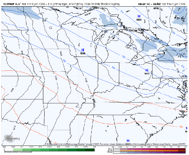
Notice it’s not just a one-and-done storm. Several waves of low pressure will develop leading to multiple rounds of precip. Just how much cold air sinks into this storm and how far south it travels are the key questions. Too early to tell at this point as a 20 mile difference is huge.
None-the-less, this storm could be a doozy for many locations in and around the Great Lakes. Heavy rain and wind is likely on the southeastern side as a strong atmospheric river of moisture will be present for several days! Where this precip meets the cold air, we’re going to have problems. Freezing rain, sleet, and even the potential for heavy snow accumulations are all possible as the moisture will be abundant.
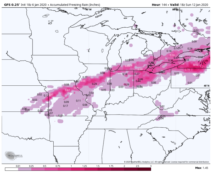
Monday night GFS model forecast for freezing rain accumulation:
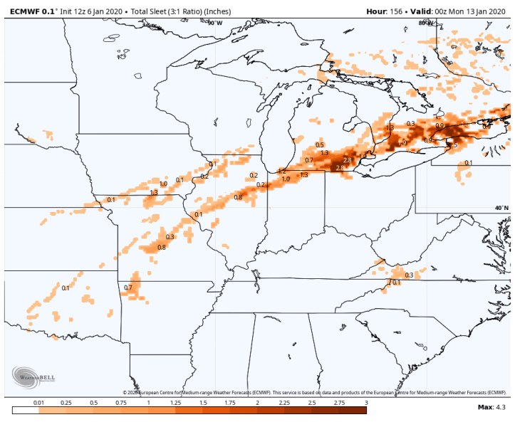
Monday night Euro model forecast for freezing rain accumulation:

Those amounts are significant in spots. Anything over a half inch of ice causes serious problems.
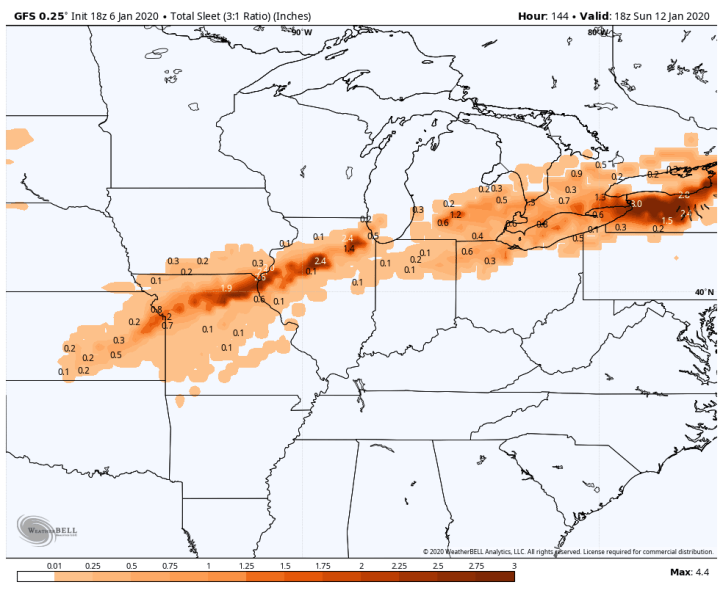
In terms of sleet amounts:
The GFS sleet potential:
In terms of snowfall, someone on the northern end of this system will get a decent amount. The GFS currently puts the strip of heaviest snow right through northern Illinois and Chicago. As we always remind you–this will change as the path of the low and strength of this system changes. Right now it’s best to stay away from amounts and keep an eye on the forecast trend.

And wow Euro. The forecast calls for a large area of heavy accumulating snow brushing us here in NW Indiana. Something to keep a close eye on.

We’ll continue to update you as we head throughout the week!
