
It’s been awhile with nearly a week and a half of relatively quiet weather across the Great Lakes–but that changes as we end the weekend into the last few days of 2019. A fairly large storm system will head out of the southwestern US and bring rain, storms, and blizzard conditions on its back side before ushering in colder air for the northern tier of the US. Let’s take a look.
Clouds will thicken and rain will develop later Saturday into Saturday night. Sunday looks like a washout at this point with waves of rainfall as the cold front approaches. Models still differ a bit on how the storm spins up once the cold front moves through–the Euro is the less snowier of the models bringing a few snow showers through as we end 2019 and begin 2020. 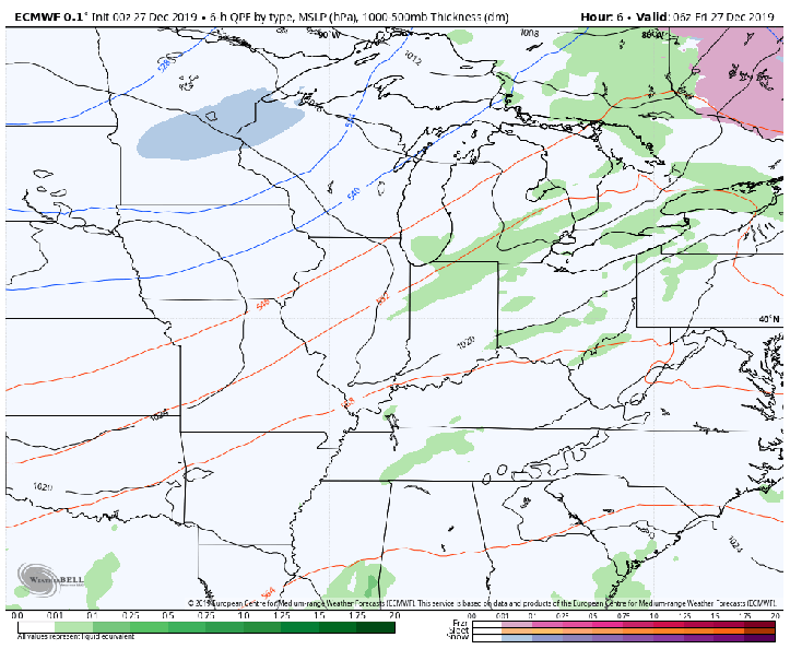
We’ll likely see some heavier rainfall at times Saturday night through Sunday night. Anywhere from a half inch to two inches are possible at this point which could lead to some minor flooding. Thankfully the ground isn’t frozen (as it could be in late December) so the soil will be able to absorb a good majority of the water.
The snowfall will lay on THICK for the northern plain and upper midwest where a foot to as much as two feet of snow will fall. There will be a period of strong 40-50mph winds creating quite the mess for them. For us, it doesn’t look like much snow at all from this storm.

Temps will tumble behind the system, but nothing frigid–just back to around average. We continue to see signs that arctic air will make a return the first few weeks of January (as you’d expect) and we’ll likely turn much snowier around here as we head through the month.
We’ll keep you up to date!
