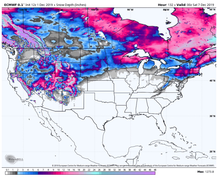
Always love looking at what the models are showing in terms of any potential snow-makers. It’s interesting to see just how much snow is on the ground in Canada as it helps lay the foundation for cold air to move into the United States over the upcoming months.
Here’s the GFS snowfall forecast through mid December. Take the later days with a grain of salt. Notice how the northeastern US gets hammered from 12-24 inches over the next few days with eastern Canada seeing several large storms through next week. Typical for this time of year.

And the respective snow on the ground over the next 10 days, including any melting. Take note of the deep snow across a large portion of the upper Midwest and then again in the northeast.