
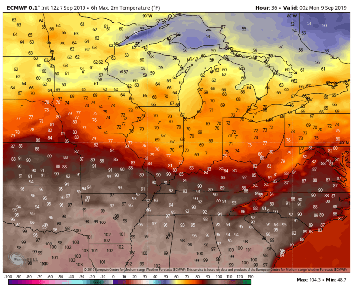
We’ve mentioned the long term trends have hinted to a warmer turn to September after a few cool weeks and now we’re able to begin putting numbers on it. Let’s look at the high temps the Euro is putting out with the latest model run…
Here’s Sunday. The heat has been ongoing for the Tennessee and Mississippi Valleys–just south of us.
By Monday, the heat begins to build north along a warm front.

Tuesday will be our transition day when the humidity will build in and we’ll be back into the warmth by afternoon.

And then it’s here to stay–but we’ll be REALLY close to the boundary between the cooler, fall-like air and the summer-like heat–so a minor fluctuation in the frontal boundary over the area would provide much cooler air instead of the heat…
Wednesday:

Thursday:
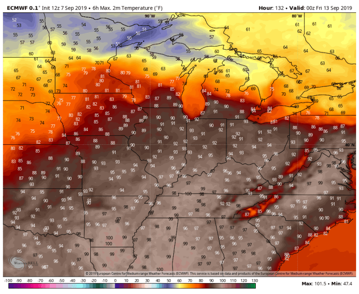
And then by Friday and Saturday, the Euro has us cooling off a bit behind a cold front, but the heat may return quickly after that. Take a look at model output for NEXT Sunday:

Summer’s not over.
