
We almost made it to 3 consecutive days without rain, but a wave of low pressure along a stalled out frontal boundary will quickly bring an end to our dry weather. Let’s start with the big picture:
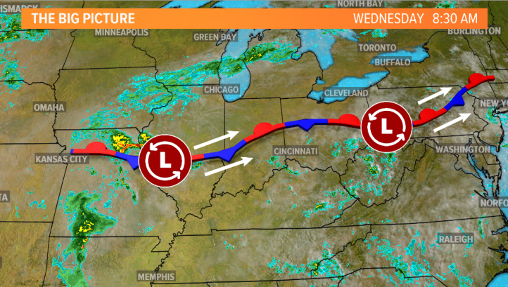
A stationary front sits just to our south and little impulses of energy have been working along that boundary for days–the last of which will work into the Region and areas to our south this afternoon and evening.
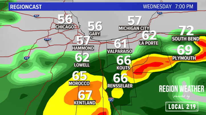
Rain will return, heavy at times, by afternoon into the evening. The heaviest rain and embedded storms are expected to be in Newton and Jasper counties.
Showers and storms will continue off and on overnight as the low pressure wraps itself up over the Region. In terms of severe weather, we’re expecting the strongest storms to stay south of the Region but we could see a few gusty storms in Newton and Jasper counties.
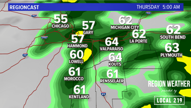
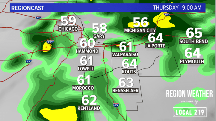
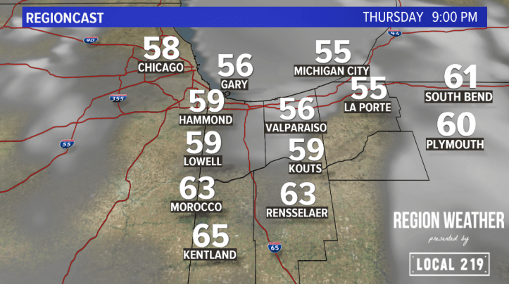
We’re dealing with the back side of the storm system during the day Thursday with a rather raw day expected. Temps will hold in the 60s with rain likely for much of the day.
By Thursday night, we’ll begin to bring a much drier airmass in…and cooler too. This should bring an end to the rain and the stagnant weather pattern. Refreshing air looks likely for Friday!
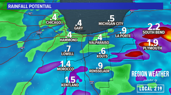
In terms of rainfall amounts, thunderstorms are efficient rainfall producers. Most areas will see anywhere from a half inch to an inch of rain, but where those thunderstorms develop (highest chances south), we could see well over an inch of rain leading to localized flooding.
We’ll have updates as needed on our Facebook page: Region Weather on Facebook
