
WHAT WE KNOW:
- Impactful snow still likely for the Region Saturday
- Potentially heavy lake effect snow Sunday
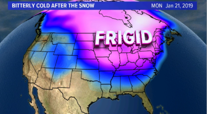
- Bitterly cold air moves in Sunday and Monday
THE SETUP:
A major winter storm is still expected across the eastern US beginning Friday and lasting through Sunday before it heads off the eastern seaboard. This storm will be complete with a large area of heavy snow, strong winds, and even severe weather on the southern end. Behind the storm system, bitterly cold air will be dragged southward from Canada bringing the coldest air of the season to a good majority of the Eastern US including us here in the Region.
We have no precip-type questions for us here in NW Indiana–it’ll all be snow. The questions lingering today (Wednesday) are:
- Exact track of the low-it’s shifting just a tad further south with the latest model runs and it’s also has a tad more speed. This will result in slightly lower snowfall totals and a shift south with the heaviest snow. Several inches would still be likely in NWI Saturday.
- Amount of available moisture-it’s always a challenge to predict exactly what the radar will look like several days out. Will slightly drier air get pulled in from the north and disrupt organized bands of snow or will we have a solid band of uninterrupted snow? These are the details that get sorted out right before the event.
LATEST MODEL RUNS
The latest Euro run:
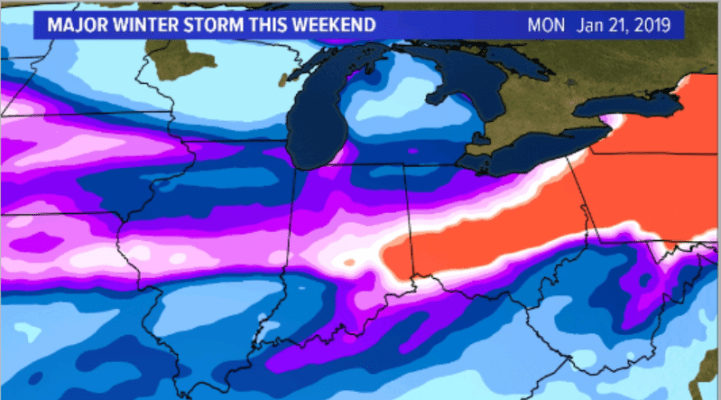
Each color represents an inch–so the red color is a foot or more with purples representing 5 or more inches. Don’t get attached to totals yet. They’ll change. At this point (3 days out) I look for trends and the trend is a bit further south with the heaviest snow–we would still get a decent, impactful snow in the Region, especially with the strong wind.
The latest GFS:

Same idea with heaviest snow just south and east. That’s it for now, we’ll keep you updated on the latest–bottomline, we’re still expecting an impactful storm for the Region Saturday and Sunday! Follow us on Facebook for the latest updates HERE
