
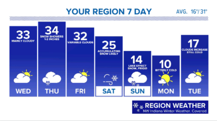
We knew we were on borrowed time with the mild December and start to January. Just knew it. Our weather turns wintry and very active in the Region over the next 7-10 days. Here’s the breakdown:
TODAY | Patchy freezing drizzle continues, otherwise cloudy. | Low 30s
WEDNESDAY | Lingering clouds, some sun possible. Spotty freezing drizzle | Low 30s
THURSDAY | Snow showers develop, inch or two possible. Wintry mix possible south of I-80. | Low 30s
FRIDAY | Variable clouds and quiet. | Low 30s
SATURDAY | Snow developing, potentially heavy at times. Becoming windy. Several inches possible. | Mid to upper 20s
SUNDAY | Lake effect snow possible. Windy and bitterly cold | Mid 10s
MONDAY | Mostly sunny and frigid. | Low 10s

Haven’t had a doozie of a snow storm for a while. Bring it on.
LikeLike
totally agree Linda! Still lots that could change with this one, but it looks to be a doozy for someone!
LikeLike