
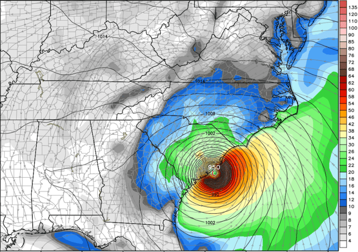
Hurricane Florence continues to barrel its way east towards the Carolina shoreline and the latest models continue to paint what will likely be devastating impacts to portions of the Carolinas. As of this Tuesday evening post, Florence is a Category 4 major hurricane with maximum sustained winds at 140mph. It continues to head WNW at a good clip and will be nearing the Carolina shores during the day Thursday.

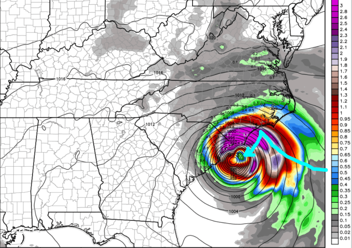
Models have changed a bit in the last 24 hours and now bring Florence right up to the North Carolina shoreline near Wilmington.
They then take Florence further out to sea once again with a track that heads southwest towards South Carolina–all the while it’s hugging the coast, is still a powerful hurricane, and is raking coastal locations with strong winds and flooding rains.
And then inland near Charleston.
The Euro brings the remnants into Georgia near Atlanta and then up in the Ohio Valley as the jetstream gets ahold of it.

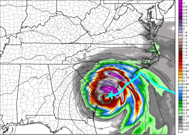
The GFS paints a similar picture. Up to the North Carolina coast…

And then it takes a turn southwest along the coast into South Carolina.
And then a bit more of a turn to the north than the Euro.
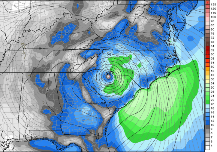
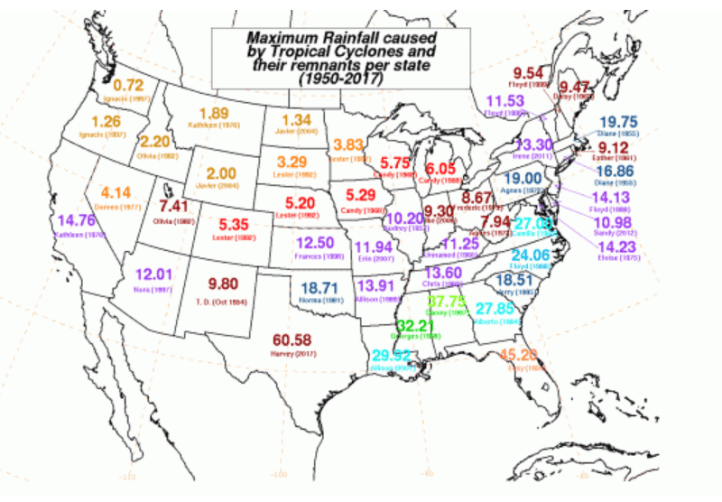
In either scenario, this will be a historical storm for many locations in the Carolinas with impacts being felt, not just from the incredible winds, but from the days upon days of tropical rains. Looking back in history, these are the highest rainfall amounts per state from a tropical system:
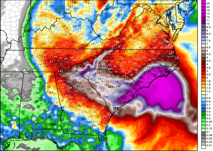
Both North and South Carolina may well break the all-time records for rainfall from a tropical system–here’s the Euro rainfall projection with 10-20 to even 30 inches of rain potentially.
We’ll have frequent updates over the next few days as this major hurricane is set to impact the east coast…
