
We discussed the weekend heatwave in our last update, but let’s break down the numbers with this next wave of hot temperatures heading towards NW Indiana:
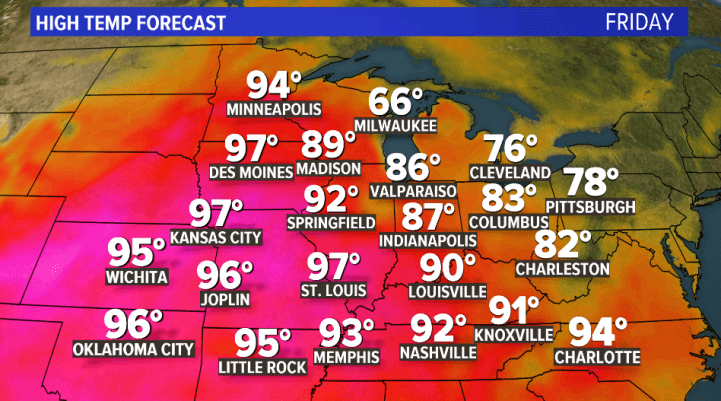
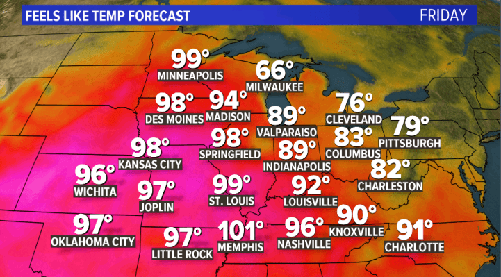
Let’s start with Friday. The core of that heat is building in the central Plains, but won’t quite make it to NWI. It’ll be warm, but not hot:
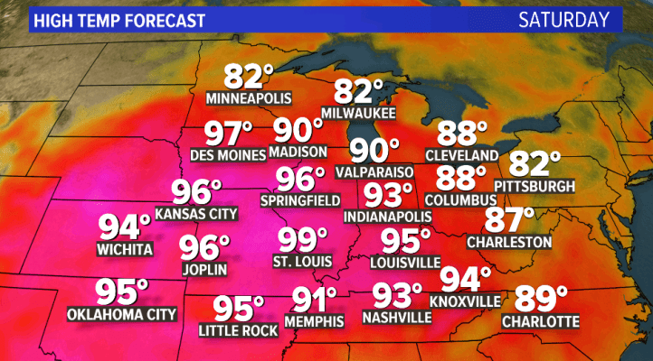
By Saturday that core of heat begins to move into the Region. We’ll likely see some shower or thunderstorm activity around the western Great Lakes where this heat meets the cooler air to our north. Any clouds or rainfall will help to keep our temps down–but I’m not counting on it. You’ll notice that the humidity will increase on Saturday as well:
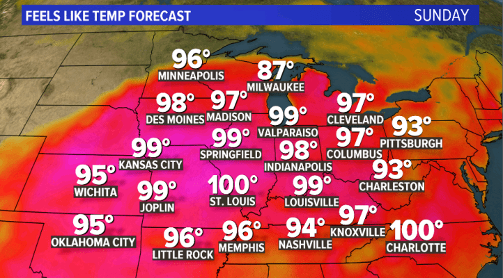
We’re forecasting Sunday and Monday to be the hottest days with temps potentially well into the 90s. Any shower and t’storm activity would be to our north along that boundary, but given the heat and humidity we may spark an afternoon storm close to the lake, but our next real chance of rain doesn’t arrive until Monday and Tuesday as a cold front moves in. Here’s a look at Sunday’s highs:

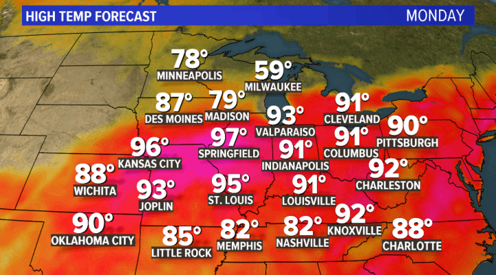
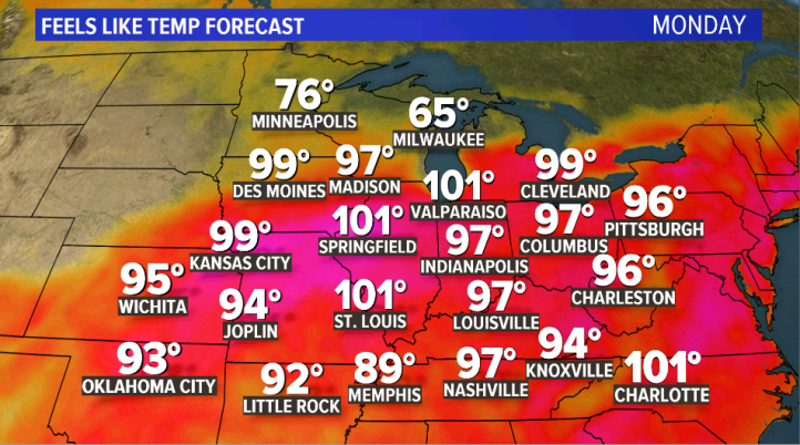
And Monday as a front approaches. Notice the cooler air moving in from the north–it may make it here by Monday afternoon/evening. Monday will likely be THICK as humidity tends to collect (or pool) along fronts. It will be downright uncomfortable right before this front arrives:
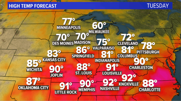
By Tuesday, we should be back into more pleasant air depending on the timing of the front itself:
Temps matter, but your “feels like” temp is what we should focus on as we combine the heat AND the humidity. Here are the results…
Friday feels like temps:
Saturday feels like temps:

Sunday feels like temps:
Monday feels like temps with that thick humidity I’m forecasting:
And finally the relief on Tuesday:

