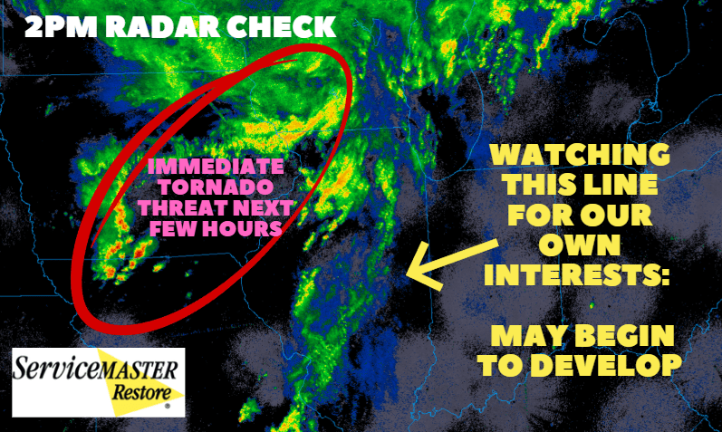
Hi everyone–just a quick email check in for you regarding our severe threat the rest of the day. We’ve warmed up and that humidity has arrived. We’re nice and dry out ahead of all the main action to our west. It’s been just rain for the most part until you get to Iowa and northern Missouri where the storms are now firing. A Tornado Watch has been issued well to our west–these storms will be the main focus through 4pm and won’t affect us.
What we WILL be watching is the line to our west. I would expect some thunderstorm development along that which we would see move through the Region in a few hours if it gets going. Severe threat is still on for the Region this afternoon into the evening–still thinking the bulk of the tornado threat stays to our west–but time will tell and we’ll need to be prepared regardless.