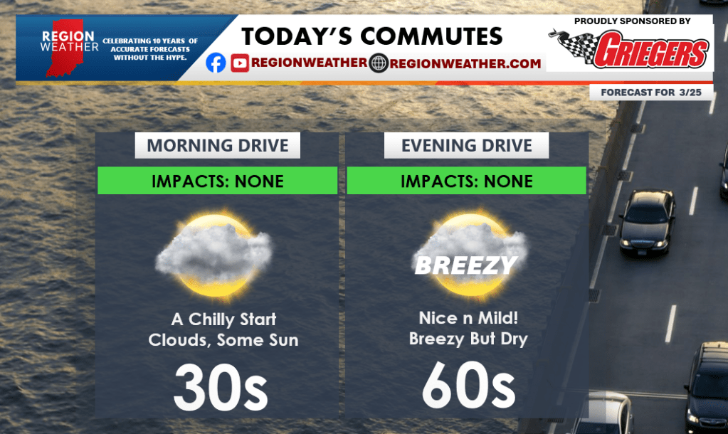
Good Wednesday morning everyone! We have a nice day in store today with warming temps and dry conditions. Both commutes look just fine:
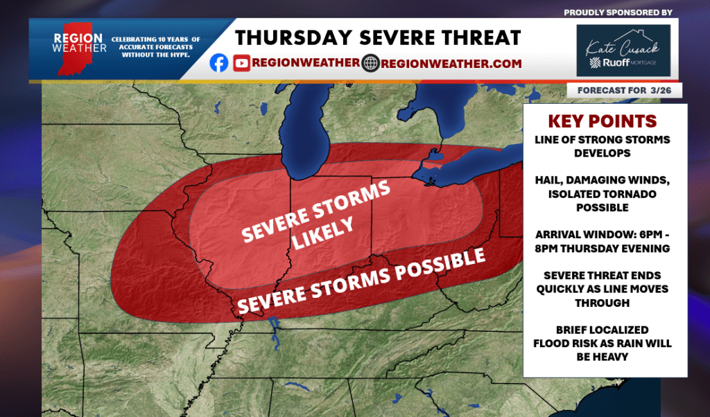
Then our attention turns towards our severe weather threat tomorrow. Our next cold front will approach from the northwest during the day Thursday and it carries with it a severe threat and a dramatic temperature drop. Storms are expected to develop in a line just to our northwest sometime around the evening rush hour. They would then surge through the Region tomorrow evening as cold air rushes in at the same time. Out ahead of this we’ll enjoy a summer-like day with highs pushing well into the 70s if not into the low 80s in spots! We’ll keep you updated on our storm threat–see the details in our graphic below.