ONE MORE MILD DAY
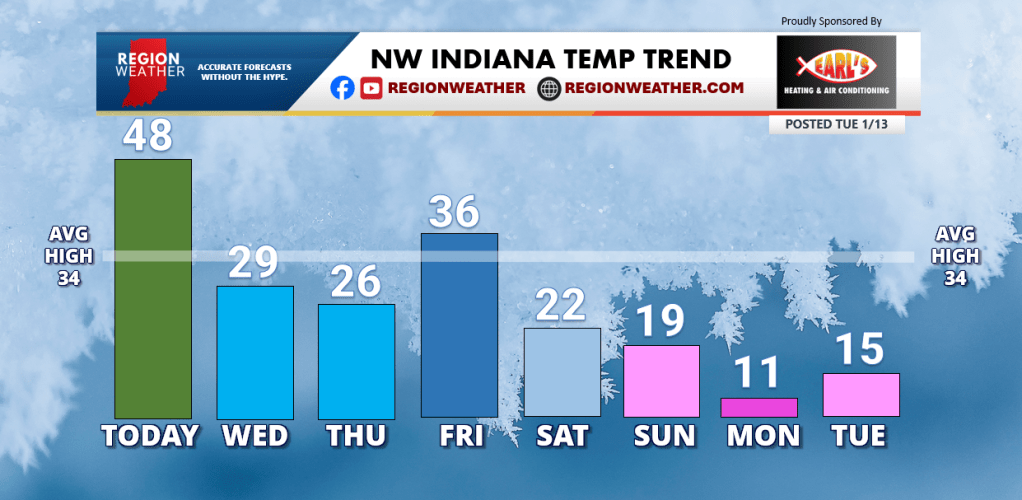
Good Tuesday morning everyone–we have one more mild day today before winter opens the door again. Expect a breezy day today with temps pushing the upper 40s to low 50s in northwest Indiana. Our temp slide begins tonight into Wednesday morning with falling temps expected during the day tomorrow. Several additional systems will reinforce cold air through the weekend into much of next week.
This is a good time to check on that furnace before the cold hits. Earl’s Heating and Air Conditioning will take care of everything for you as they’ve been doing since 1976!
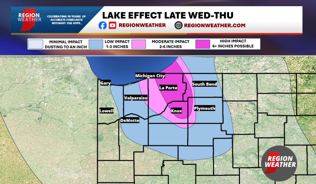
FIRST LOOK: LAKE EFFECT WEDNESDAY-THURSDAY
A strong cold front will move through the Region Wednesday morning ushering in a sharply colder airmass that will help ignite snow showers and lake effect snow. It shouldn’t take long for a more organized band of lake snow to get going and with our expected northwest flow, we’ll bring this band of snow into areas of LaPorte County. We’ll likely have additional bands of snow coming off Lake Michigan elsewhere, but on the lighter side. You know how this goes–this band of snow will waffle back and forth potentially bringing some lake snow into Porter and Starke Counties at times through the day Thursday.
Important notes:
1. Outside of this band of snow? Not much at all.
2. Some model guidance shows very little snow out of this event.
3. This won’t be a blockbuster event by any means, but snowy travel is likely.
This is our initial shot at snowfall potential out of this–check back for updates as we should begin to have a better idea of how this lake effect band will behave as we inch closer to the event!