
A powerful storm system will move through the Great Lakes today and tomorrow bringing huge temperature swings, the potential for severe weather, and strong winds. This one is a doozy! Let’s break down our local timing and impacts.
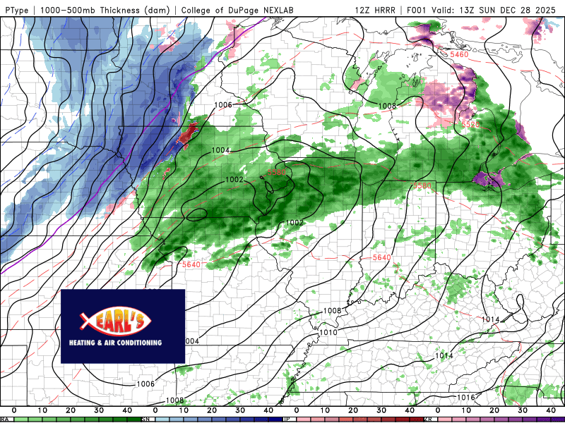
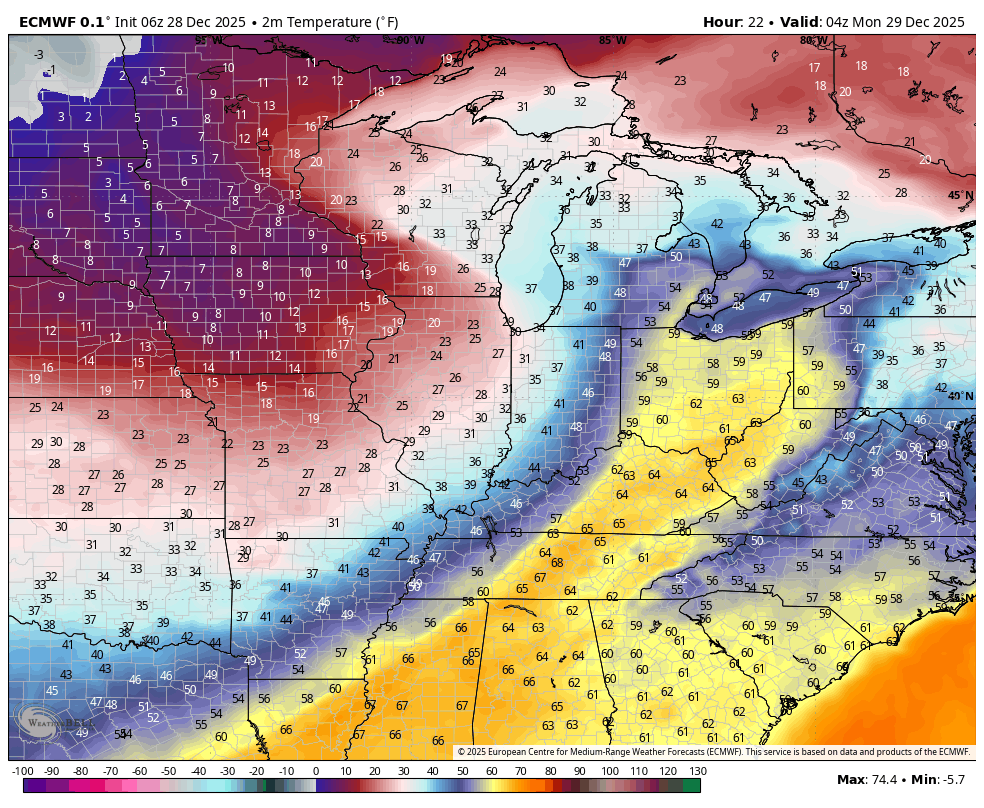
Rain will be around for much of our Sunday morning through afternoon. A few thunderstorms are possible as a warm front makes its way north through the Region this morning. This warm front will help our temps surge into the 50s and 60s out ahead of the actual cold front!
We’re expecting the front to move through this afternoon, sometime in the 3-6pm timeframe. It will pass with a fast moving line of rain and storms and the temps will begin to fall immediately—going from the 60s into the 10s tonight. A Flash freeze is possible, but the wind will be howling and will help dry up a lot of surfaces so it shouldn’t be a huge deal.
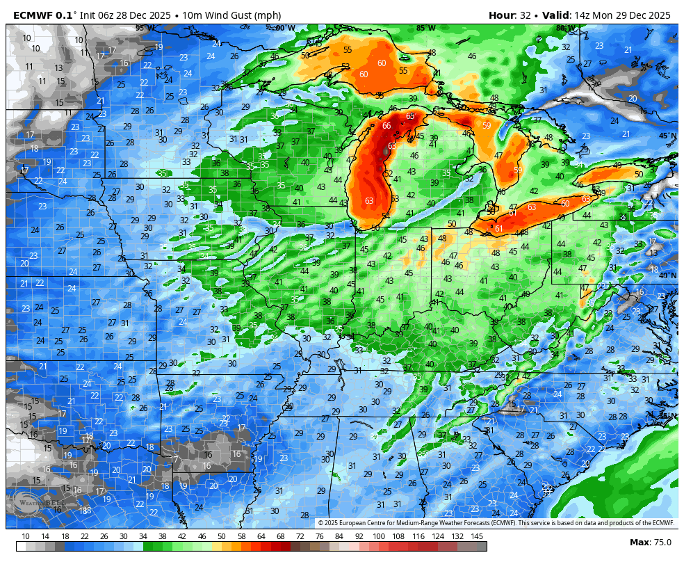
The wind is what you’ll notice as well. During the day it will be breezy out ahead of the front in the warm air, but as this low deepens, the wind will really ramp up once the front goes through with gusts over 50mph likely. Gusts could exceed 60-70mph in portions of the Great Lakes, especially out over open waters on the lakes themselves. Power outages are certainly possible.
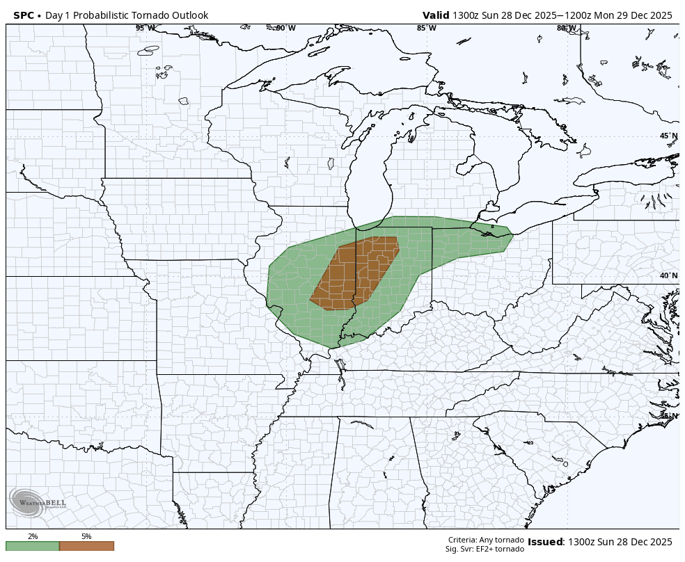
Another component is the severe thunderstorm potential! Yes, in late December! Our main focus will be on that potential line that develops this afternoon along the front. It would be a quick hit, but these storms could tap into the powerhouse winds above us and bring damaging winds down to the surface. There’s not a ton of instability but there’s plenty of shear so a tornado or two can’t be ruled out. Just crazy.
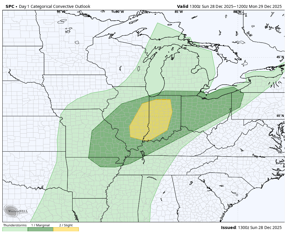
Timing for the severe threat would be with the passage of the front between 3-6pm is what we’re thinking.
The final component will be the snow and wind on the backside. We won’t get much snow from this, but tonight into tomorrow as the cold air gushes in, we’ll see widespread snow showers, especially in the snowbelt east—combined with the powerful winds we could have some very tricky travel with any squalls that move through. Snowfall totals will remain on the light side.
Buckle up! This storm system means business and we’ll be going through some big changes over the next 24 hours. We’ll keep you updated!
