
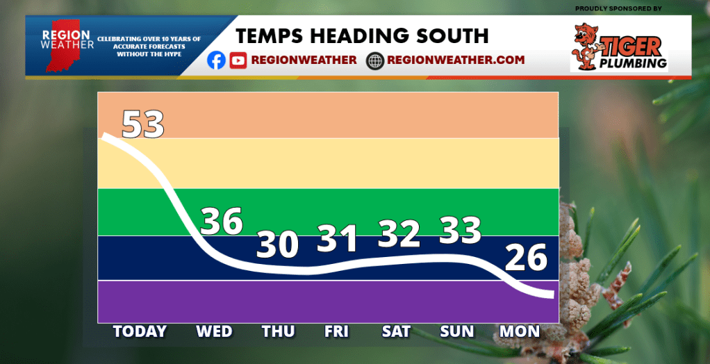
LAST MILD DAY TODAY
Good Tuesday morning! We have our active weather pattern with a lot coming at us weatherwise the next 6 days. Let’s start with our temp drop on the way. Our temps will head south tonight and will hold in the 30s for highs through the weekend. Nothing out of the ordinary here, but it will feel a lot different than our mild air we have now. Wind chill values with a howling wind tomorrow will drop into the 10s for much of the extended. Another shot of colder air is possible next week as we look to kick December off on a cold note!
This system coming in with the cold air tonight will kick off lake effect snow tomorrow to our east. We’ll all experience strong gusty winds as this cold air blows in as well–gusts could go over 40 mph at times tonight and tomorrow.

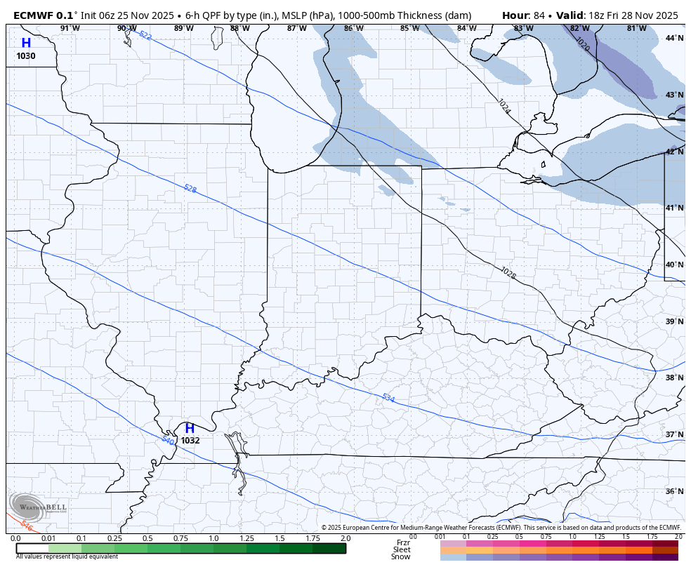
Attention then turns to the potential for accumulating snow area-wide Friday night into Saturday. An area of low pressure will move in from the southwest bringing lots of moisture with it. We’ll have plenty of cold air in place so our precip is likely to be a wet snow when this moves in late Friday into Saturday. Depending on how the low evolves, it may stick around for a while bringing accumulating snow to the Region through Saturday night. Still too early to talk totals, but some decent and impactful snow is possible Saturday with slowly improving conditions Sunday for the big travel day back. Make sure this isn’t the last forecast you see–stay up to date on the latest as this active weather pattern continues.

THANK YOU MATT!
LikeLike