As we approach the all important Thanksgiving travel week, we’re getting a good idea of how things will go down weather-wise across the country. We know we’ll have a shot of cold air trying to get into the US and that will spin up a series of storm systems next week–some of which will be impactful to travel across the country. Let’s break it down day-by-day.
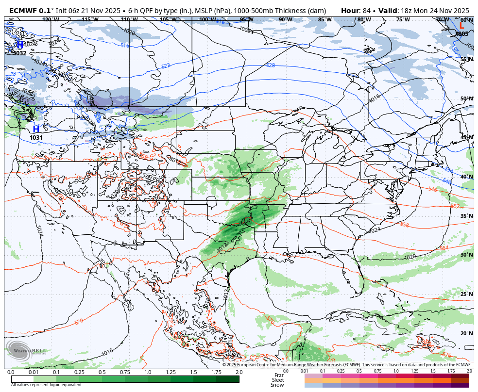
MONDAY
A storm system will get going in the southern and central Plains on Monday. Locally across the Great Lakes we look good travel-wise. Clouds will be increasing and there will be some rain moving into areas like Chicago later Monday. Biggest travel impact zone: Missouri, Arkansas, eastern Texas.
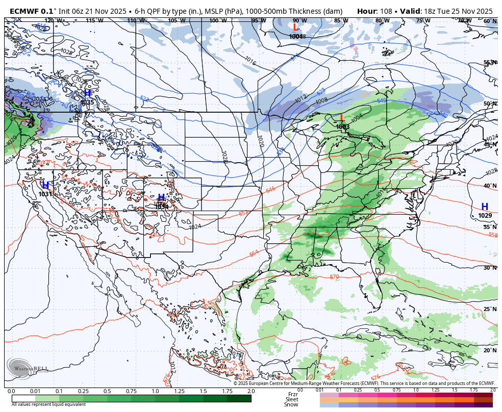
TUESDAY
This low pressure gets going with an elongated band of rain from Michigan through Louisiana Tuesday. The I-65 corridor will be wet from Kentucky to the Gulf Coast. Meanwhile some snow will be possible with gusty winds in the northern tier of the US. Biggest travel impact zone: Great Lakes south through Deep South.
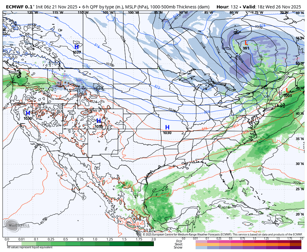
WEDNESDAY
The storm system continues east with rain across PA into NY with additional thunderstorms down in Georgia and northern Florida. This system will bring gusty winds into the Great Lakes as cold air begins to move in. Snowflakes will be flying in northern Michigan up towards the U.P. while another system brings soaking rain and wind into Portland. Biggest travel impact zone: NE US and out west in Oregon and Washington.
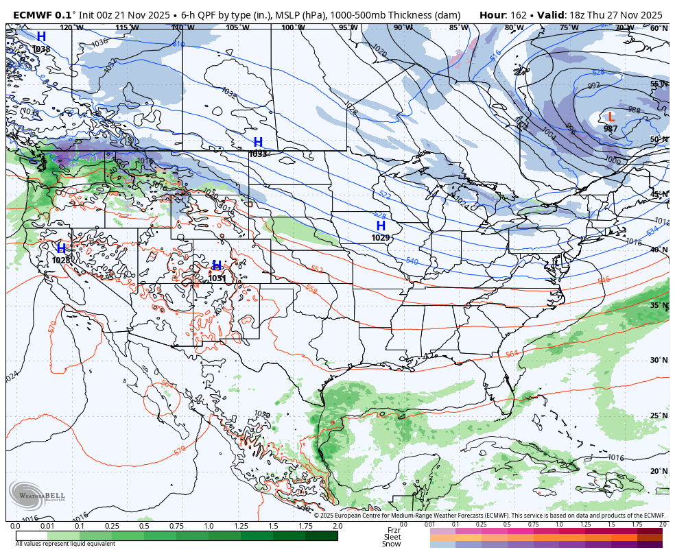
THANKSGIVING
Conditions quiet down across the Great Lakes and lake snow begins to develop in spots. Cold air and a gusty wind takeover the eastern US. The western system takes primary attention bringing heavy rain, mountain snow, and strong winds to the Pacific NW into the northern Rockies. Biggest travel impact zone: Pacific NW and eastern Great Lakes with lake effect (Erie to Buffalo, Syracuse to Watertown NY)