
Good Monday morning everyone! First and foremost–thank YOU for subscribing to our daily emails. My goal is always to be short and sweet with these, giving you the LOCAL weather information you need…but to still be a real human being behind the typing! I appreciate you.
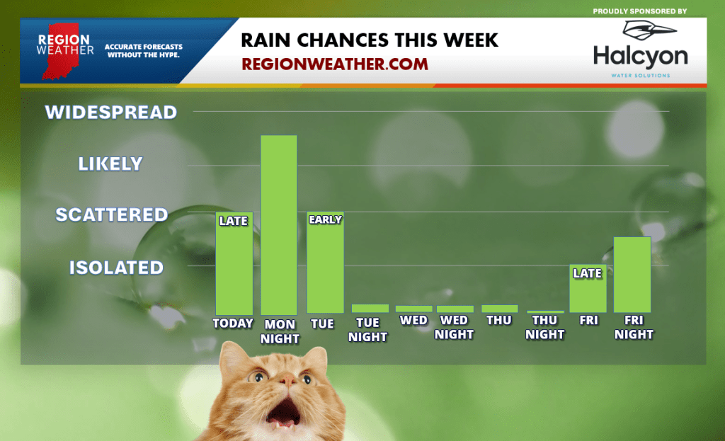
Weatherwise, look at us, talking about these rain chances again! We’ve come a long way. We’re not looking at a lot of rain–but the radar will be active late today into the overnight. We’re looking dry until a few pop ups show up late this afternoon into the evening. Our best shot at rain and a few rumbles arrives tonight into the first part of the day Tuesday. Another shot at a few passing showers exists later Friday. Still lots of dry time this week before another pattern shift arrives next week perhaps bringing us better shots at multiple days of rain.
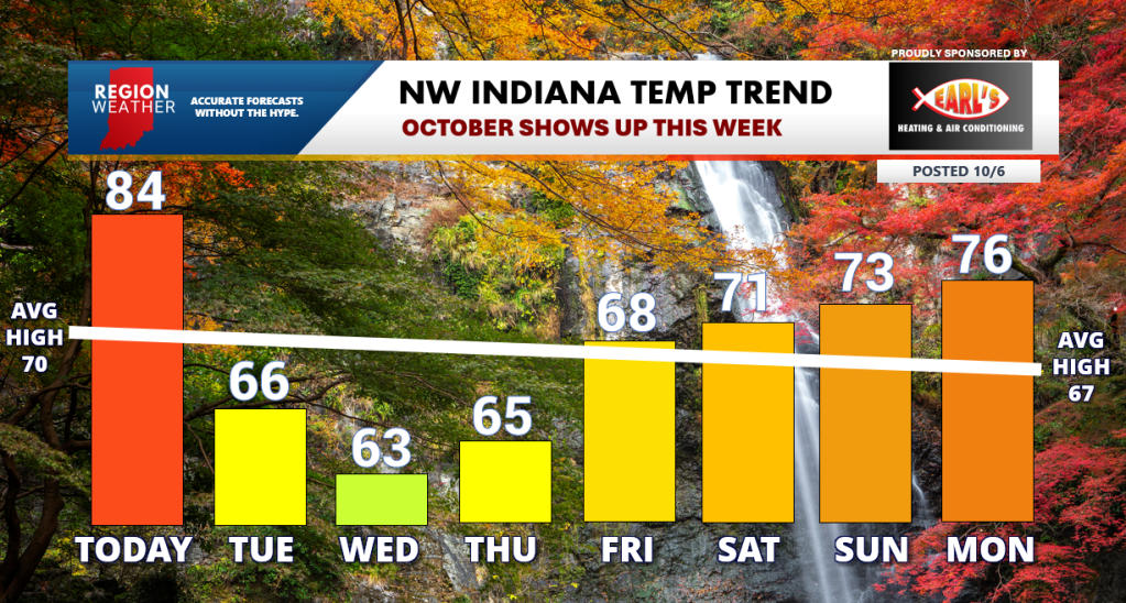
Temps are the other big story. We have a healthy 20 degree temp drop coming our way with our high temps this week between today and tomorrow afternoon. This is all with a cold front that will bring rain back into the Region late today into tonight. Cooler air sticks around for a few days before we moderate out ahead of what looks to be an even better punch of Fall air sometime around October 18th-ish. Changes are coming!
Here’s our video update from this morning if you have extra time at the office to be unproductive 🙂
