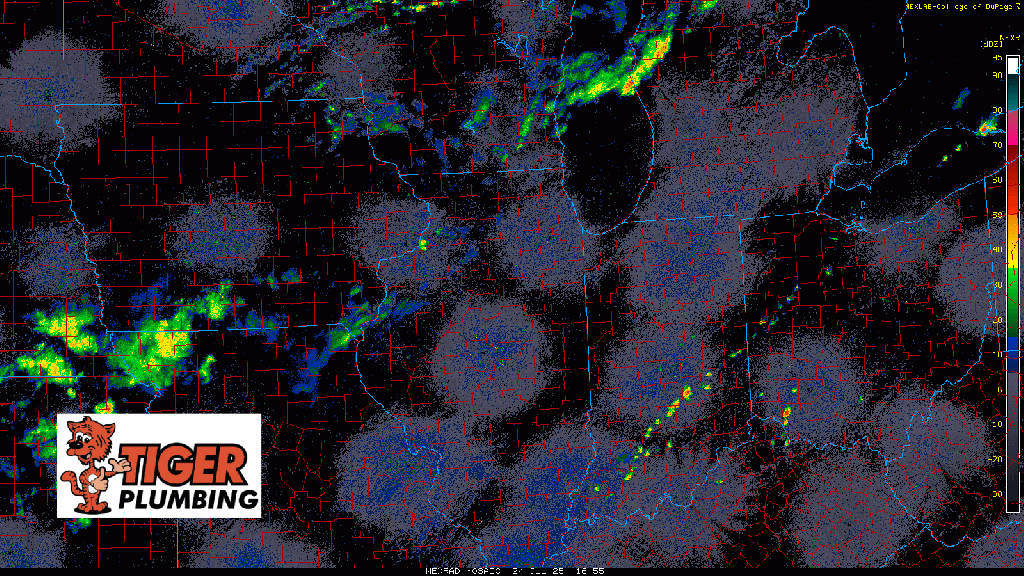
3PM CT Update: Storms are erupting to our northwest as expected this afternoon and they’re tapping into our incredibly unstable environment. Dewpoints are sky high again and with temps in the low to mid 90s, there’s plenty of fuel for these storms to push upwards of 55,000 feet (or higher) in the sky.
As a result, we get some incredible downpours and pockets of strong, damaging winds from downdrafts within these–and this is what we’ll keep tabs on as this line fills in and eventually makes it’s way into the Region.
The storms moving through Chicago are already putting out outflow boundaries will may trigger more storms to the south of this line which would include Lake County (Indiana) first. Expect a stormy late afternoon and evening around here. We’ll go LIVE as needed over on our YouTube Channel and FB page the rest of the day to keep you updated!