
Good Wednesday morning everyone–grab a good cup of coffee and let’s dive into the latest thinking regarding today’s severe weather risk. If you joined me last night in our broadcast on our Region Weather Facebook Page, we talked in detail about how these storms are expected to develop. Let’s set the stage first.
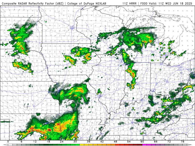
It’s another warm and humid start to the day. We had an area of rain and rumbles overnight and I’m expecting a decent lull in storm activity throughout the rest of the morning before storms get firing along and ahead of an area of low pressure to our southwest.
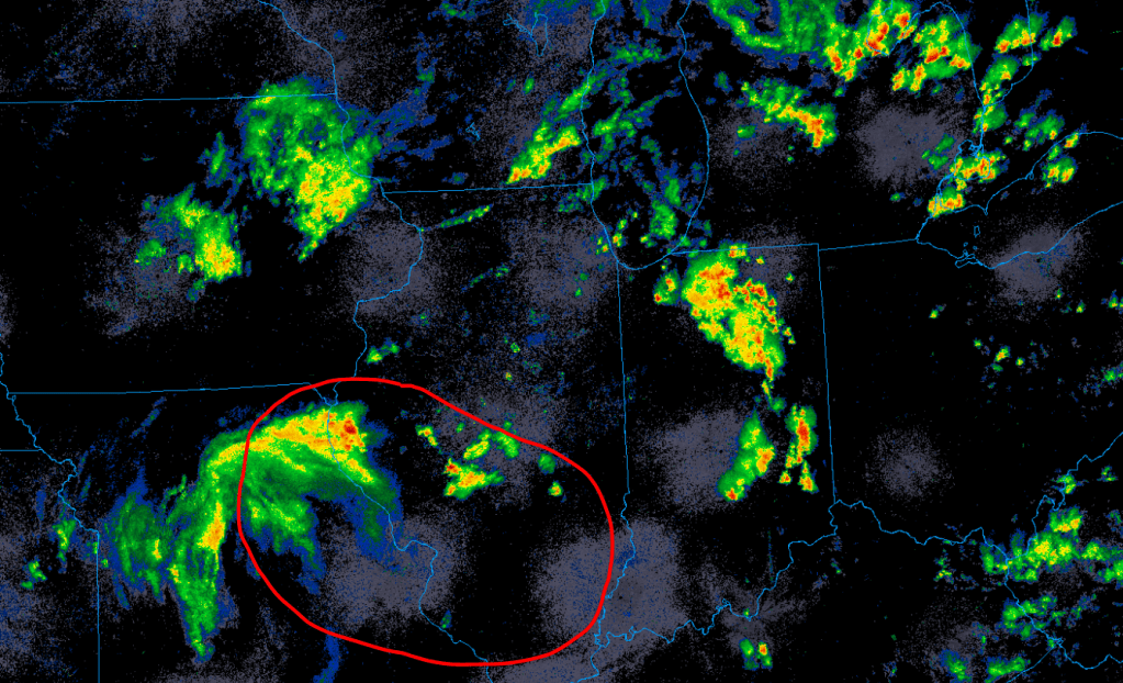
This low pressure will push into our warm and humid air and will likely pop storms quickly in and around the Region early this afternoon. These storms would get going quickly and would likely go severe as our atmosphere will be loaded with instability and plenty of lift.
The SPC has expanded the enhanced risk region to cover all of NW Indiana in anticipation of these storms.
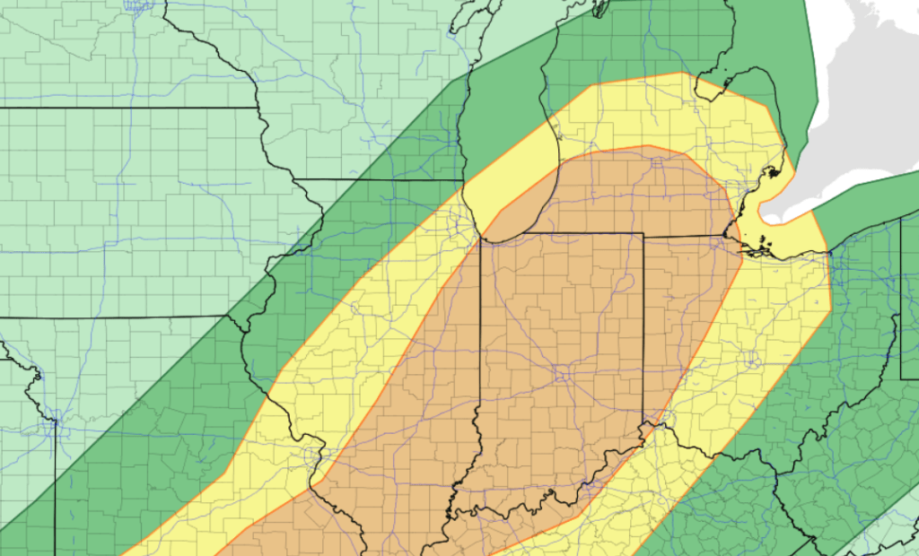
All modes of severe weather are possible with damaging winds and very heavy rain being the primary risks. We also can’t rule out large hail and a few tornadoes as we have plenty of shear locally. We’re still expecting the storms that develop to form into more of a line segment once they head east through Indiana with damaging winds becoming the primary risk further east.
Again, the timeframe we’re looking at is midday through mid-afternoon from west to east–so make sure you have a way to get the latest watches and warnings should they be needed. We’ll have LIVE coverage as needed on our Facebook Page as well to keep you safe as these potential storms develop and move through…
