When most people think of stormy weather, they envision the sweeping arms of a hurricane or the familiar spirals of a mid-latitude cyclone. But there’s another atmospheric player that often goes under the radar—cut-off lows.
We’ve been dealing with a cut-off low of our own the last few days as it’s been swirling across the Ohio Valley since last Friday bringing clouds, downpours, and northeast winds the last few days to the Region.
These enigmatic systems can linger for days, bringing unexpected rainfall, thunderstorms, and even snow to regions far from typical storm tracks. So what exactly is a cut-off low, and why does it matter for weather forecasting?
What Is a Cut-Off Low?
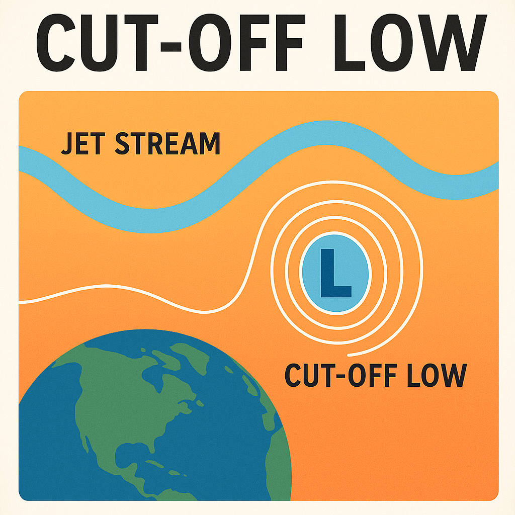
A cut-off low is a closed upper-level low-pressure system that becomes separated, or “cut off,” from the main flow of the jet stream. Think of the jet stream as a fast-moving river of air high in the atmosphere, steering weather systems across the globe. When a low-pressure system breaks away from this flow, it becomes isolated and self-contained—no longer being pushed along by the prevailing winds.
This detachment leads to one key characteristic: slow movement. While typical storm systems might sweep across a region in a day or two, a cut-off low can remain in place for several days, spinning like a top and delivering extended periods of unsettled weather to the same area.
Why Are Cut-Off Lows Important?
Cut-off lows are significant for several reasons:
Heavy Rainfall and Flooding: Because they can remain stationary, cut-off lows are capable of dumping large amounts of rain over a localized area. This increases the risk of flash flooding, especially if the terrain is mountainous or already saturated.
Thunderstorms and Severe Weather: These systems often bring instability to the atmosphere, a key ingredient for thunderstorms. Some cut-off lows have even triggered severe weather events, including hail and isolated tornadoes.
Snow in Unusual Places: In cooler seasons, a cut-off low can bring cold air down from higher altitudes, producing snow in areas that don’t typically see it.
Forecasting Challenges: Cut-off low=weatherman’s woe. Perhaps one of the most frustrating aspects of cut-off lows is how tricky they are to predict. Their erratic paths and sluggish behavior can make it difficult for meteorologists to pinpoint where and when the worst impacts will occur. Models are little help in determining where these systems decide to go.
Where Do They Occur?
Cut-off lows can form nearly anywhere in the mid-latitudes but are particularly common in regions where the jet stream is prone to strong meanders. In the United States, the southwestern states like California, Arizona, and New Mexico often see cut-off lows, especially during the spring and fall. Europe, Australia, and parts of South America are also familiar with these systems.
What to Watch For
If a cut-off low is in your local forecast, be prepared for a few days of unsettled weather. Expect periods of heavy rain, gusty winds, and a higher chance of thunderstorms. Because of their unpredictable movement, it’s wise to stay tuned to local weather updates and advisories, especially if you’re in an area prone to flooding.
In Conclusion
Cut-off lows are like the wild cards of the weather world. While they may not have the drama of a hurricane or the scale of a Nor’easter, they pack a punch in their own right—especially because they don’t play by the usual rules. Understanding these systems is key for meteorologists and weather enthusiasts alike, and staying informed can make all the difference when one drifts into your neighborhood.