
Good Monday evening everyone–we’re posting this at 7:30pm CT as we want to give everyone a heads up as to what’s happening on radar and what we expect to happen overnight.
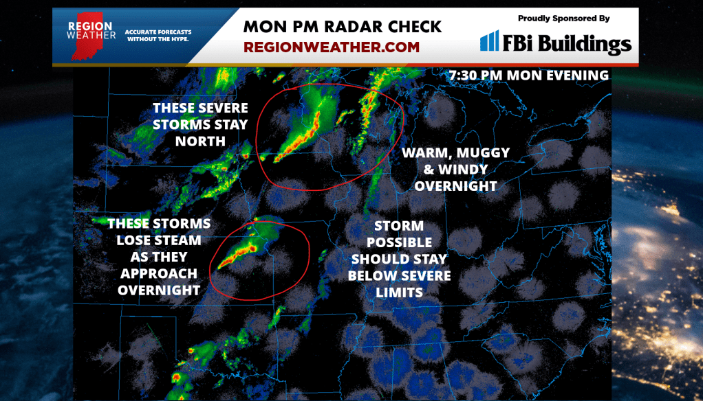
Everything going as expected weather-wise with severe weather in Minnesota–this complex will head into Wisconsin and will stay north of us tonight. There is another complex of storms in Kansas that will continue to grow in intensity over the next few hours. As it approaches the Region, this complex should weaken pretty quickly as it encounters our “cap” on the atmosphere we talked about in last night’s broadcast. We could still get a few storms out of it overnight, but we’re not expecting any widespread severe weather. There continues to be the scenario where all of this fades completely and we end up dry overnight. The front will pass through tomorrow morning and our severe weather threat will be over as cooler, more stable air moves in.
So in summary, the atmosphere is still ready to go over us, but the “lid” on our local atmosphere should win out when it comes to any storms move into the Region. Severe weather would stay north and west of us with these two complexes but we’ll maintain a storm chance overnight with our muggy lows in the upper 60s to near 70. A summer-like night!
Get some sleep!
