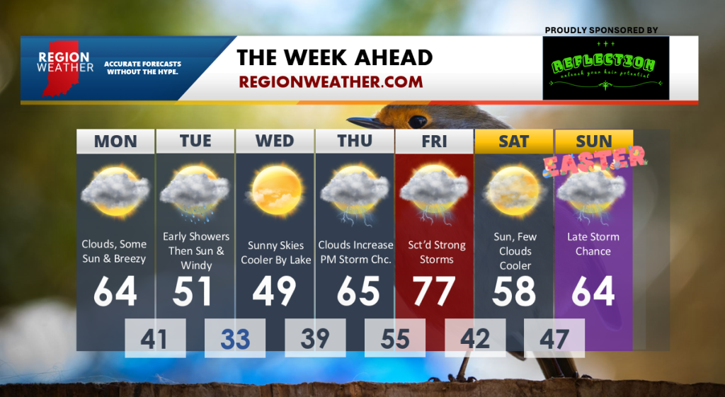
Good Monday morning everyone–we’re off and running this week with mild temps with 60s expected this afternoon as winds begin to pick up. These winds will become gusty behind a cold front that will pass through the Region without producing rain today–so we get a bonus day of decent weather! The swirling area of low pressure with this system moves in tomorrow bringing early showers and gusty winds. We could have wind gusts over 40 at times tomorrow with highs in the 40s and low 50s at best. Wednesday will be chilly as well before we bring on much warmer air to end the week. We’ll need to keep a close eye on the potential for strong storms at some point Friday as our next cold front punches into a warm, rather humid atmosphere. Easter Sunday will feature our next storm system organizing to our west–but we’re forecasting dry weather Sunday morning as of now. Overall, this spring-like feel will be with us for the majority of the next week outside of a cool day tomorrow and Wednesday. Here’s a look at our exclusive 7 Day: