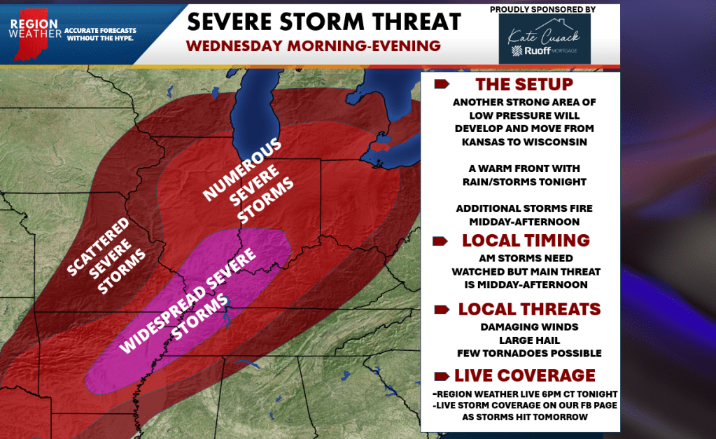
Severe thunderstorms continue to look likely tomorrow from the southern Great Lakes all the way down into Texas as another powerful low pressure takes a similar path to the one a few days ago. The Storm Prediction Center has UPGRADED the severe risk to a level 4 out of 5 downstate. For us here in the Region, we remain at a 3/5–a level we need to take seriously.
This setup is a bit different for us with rain and storms likely tonight into early tomorrow. We may not fully clear things out–but the atmosphere that will rush in here after lunchtime will be more supportive of severe weather than Sunday’s. While the highest tornado risk is well south of us, we’ll carry our own risk that requires attention. All that said–the potential is there for numerous severe storms along and ahead of this system as it moves through Wednesday afternoon into the evening.
Let’s discuss the latest in a special Region Weather LIVE broadcast tonight at 6pm CT. We’ll also provide LIVE coverage during these storms all afternoon tomorrow as needed.