
Good Saturday evening everyone–we wanted to bring you an update on our severe weather threat tomorrow with the latest info, so let’s dive in:
An area of low pressure will develop to our west near Iowa tomorrow morning and will bring a strong cold front through the Region late Sunday…strong enough that we could be talking a few snowflakes by Sunday night into Monday. All of that aside, the main focus for all of us in the Region is for the threat of strong to severe storms along and ahead of the actual cold front.
The Storm Prediction Center has much of the Region in a ENHANCED risk, or a level 3/5 as of Saturday evening:

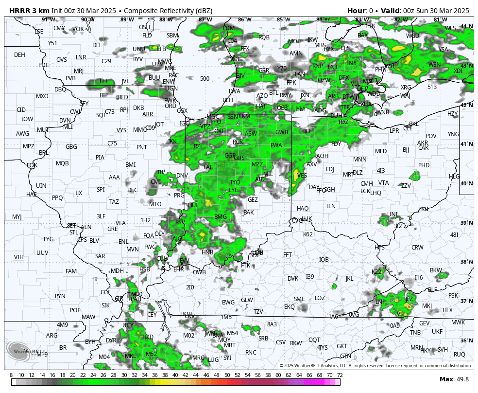
What’s changed in our model guidance over the last few hours has mainly been associated with the strength of the low pressure itself. It’s coming in a bit stronger–which would bring the potential for stronger thunderstorms. What remains the same is that we’re not 100% confident in WHERE these storms will ultimately decide to fire up. For example, our latest run (as of Sat evening) of the HRRR shows morning rain and rumbles giving way to our line of severe storms developing to our EAST. Watch how the bulk of the action develops just east of us:
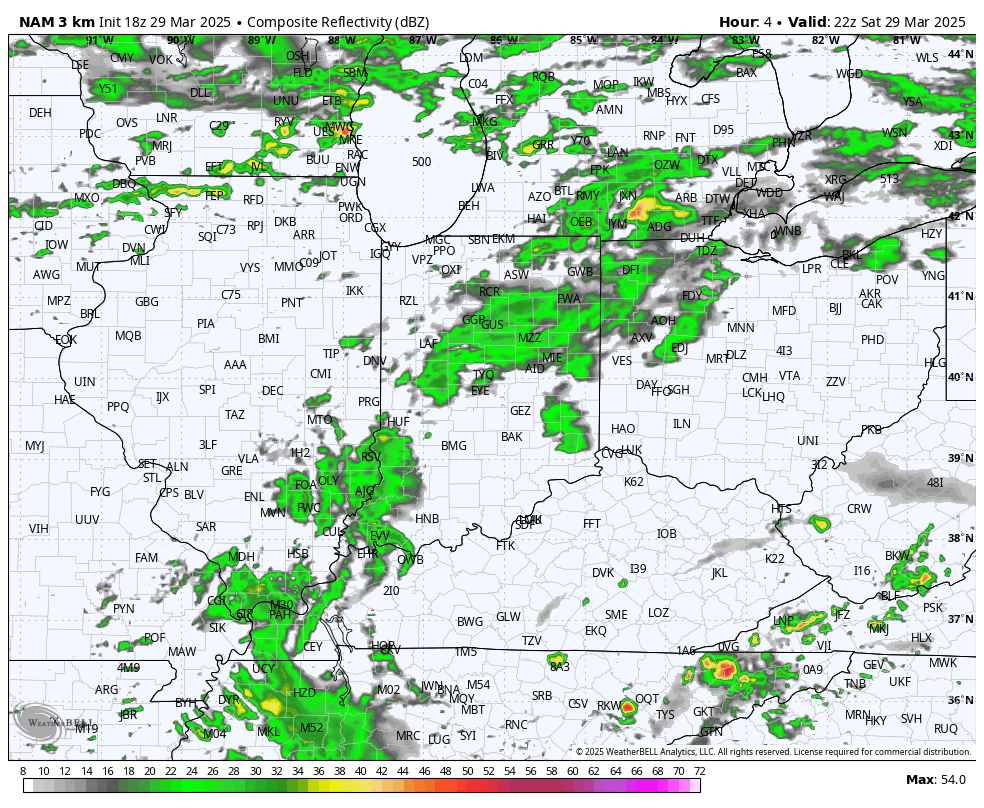
The majority of the remaining model guidance still develops these storms to our west bringing them through northwest Indiana early tomorrow afternoon. Here’s the latest example of the NAM
For now, we should plan on strong to severe storms disrupting our Sunday midday-afternoon plans as this line of storms develops and then rolls east but keep in mind, this entire thing could always miss us just to the east.
So, planning for storms, what kind of storms are we talking? Our primary risk will be for strong, damaging winds. That looks to be our main issue. Yes, there is a risk of hail and yes, there is a risk of a few tornadoes with this as well so we’ll need to be tuned into the weather. Once the front passes through during the afternoon, we’ll be all clear in terms of severe weather for our late afternoon and evening Sunday.
We’ve been through this before–just make sure you’re tuned in to any watches and warnings that get issued. We’ll likely have some rain and rumbles at times during the morning–those are not the storms we’re worried about. It will be the line along the actual front arriving anytime from lunchtime through the early and mid afternoon. And keep in mind how this always works…if we get a line of storms, not everyone sees severe weather. A lot of you won’t see anything other than a thunderstorm. But my job is to prepare all of you when the atmosphere is capable of producing property-threatening (and life-threatening in some cases) storms…so here we are. just be weather aware tomorrow. We’ll be LIVE to get you through these storms as needed on our Facebook Page so make sure you’re plugged in with us!
