First things first. Enjoy the day today, my goodness. We’re looking at a warm, breezy day with highs pushing into the mid and upper 70s this afternoon with a mix of sun and high cloudiness.
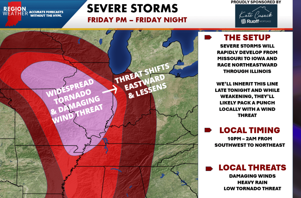
Attention then turns towards this evening. We’ll be watching a line of severe storms to our southwest roll towards the Region. As we mentioned in our broadcasts the last few nights, we’ll likely be looking at multiple tornado warnings in Illinois with these storms–but keep in mind their environment is different than ours and these storms will begin to move into a less favorable environment locally. That being said, these storms will be moving 60+ mph towards us and will still be packing a punch with damaging winds as the main threat as they move through anytime after 10pm. Keep in mind, this doesn’t mean everyone will get severe weather–but the potential is there for any storms to produce these strong winds. The tornado threat will need to be watched as well, but I continue to be more concerned about damaging wind potential with these. We’ll have updates as needed this afternoon including a LIVE broadcast on our Facebook page late this evening to keep you up on the latest. Stay tuned!