BIG STORM SYSTEM MOVING IN
There are a LOT of weather headlines with this big storm system that will be moving into the central Plains and Midwest tomorrow, so we want to simplify things to our local level with a timeline.
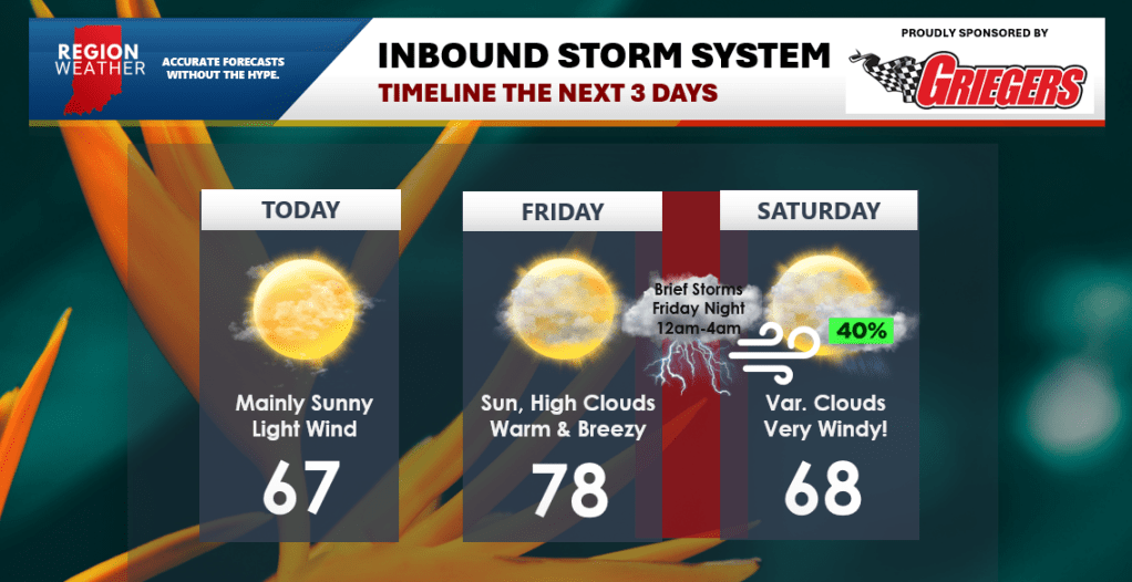
TODAY
No issues at all. A beautiful day with a light breeze. Mid to upper 60s.
FRIDAY
Summer-like! Sun with high clouds. Becoming breezy. Unseasonably warm with highs in the upper 70s. Dry all day.
FRIDAY NIGHT
As we mentioned in our broadcast last night, we’ll be tracking a fast-moving line of severe storms in from the southwest. This line will be weakening as it moves in, but could still pack a punch with strong, potentially damaging winds. Arrival time would be after midnight. Outside of this line of storms it will be very windy with gusts over 45 mph.
SATURDAY
Variable clouds and very windy with gusts over 50 mph possible! A lingering rain chance as the front pushes through with warm temps in the upper 60s to low 70s before they drop off later in the day.
We hope this helps! We’ll have updates as needed over the next few days!