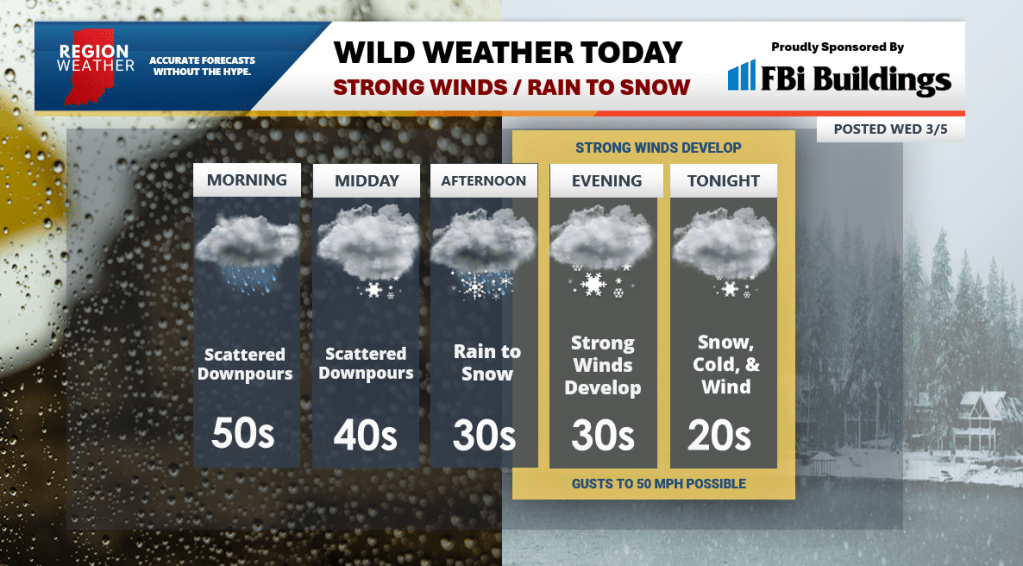
We’re at the top of the rollercoaster this morning with temps in the upper 40s and low 50s. Buckle up! Our powerful low pressure system is overhead and will move off to the northeast today bringing the backside of this entire system featuring strong winds, tanking temps, and rain that changes to snow. It will feel much different around here for that evening commute vs our morning trip!
In terms of rainfall–scattered downpours will be with us throughout the day before a more organized area of rain moves in and then changes to snow just in time for that evening commute. Road surface temps will still be above freezing, so we shouldn’t have any major problems for the commute home. As temps continue to fall this evening, we’ll likely get a little slick on untreated roads into the overnight.
Winds will become much stronger later this afternoon into the evening. Gusts over 40 mph will be common and Lake Michigan will respond with 12-16 foot waves! Lakeshore communities can expect beach erosion and coastal flooding through tonight. We’ll calm things down on Thursday (eventually) with the return of sunshine and easing winds.