
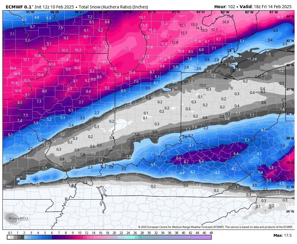
Good Monday afternoon everyone! The fresh model data is out and there really hasn’t been much change in the upcoming forecasted snowfall amounts with this system. The Euro continues to hold on to it’s 6-11 inch output. Notice the sharper cutoff between our northern counties and our southern counties where some ice may mix in with a general 3-6 in those southern areas.
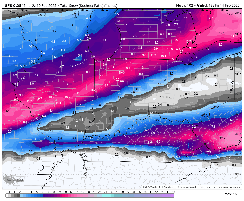
The GFS has come up from recent runs but continues to paint snow further south as well with a general 7-9 inches of snow across the Region with the heaviest amount just to our south as it tracks the low further downstate.
And finally the GEM brings a healthy 6-10 inches through the Region as well with a larger area of moderate to heavy accumulating snow.

For now, we’ll go with a general 5-10 with this one locally with a lesser confidence in our southern counties for now. Tomorrow we’ll be able to lock in on totals for everyone–but it all depends on exactly how far north that low tracks and where the main band of snow on the northwest side of the low develops. Stay tuned!
